MyTopo
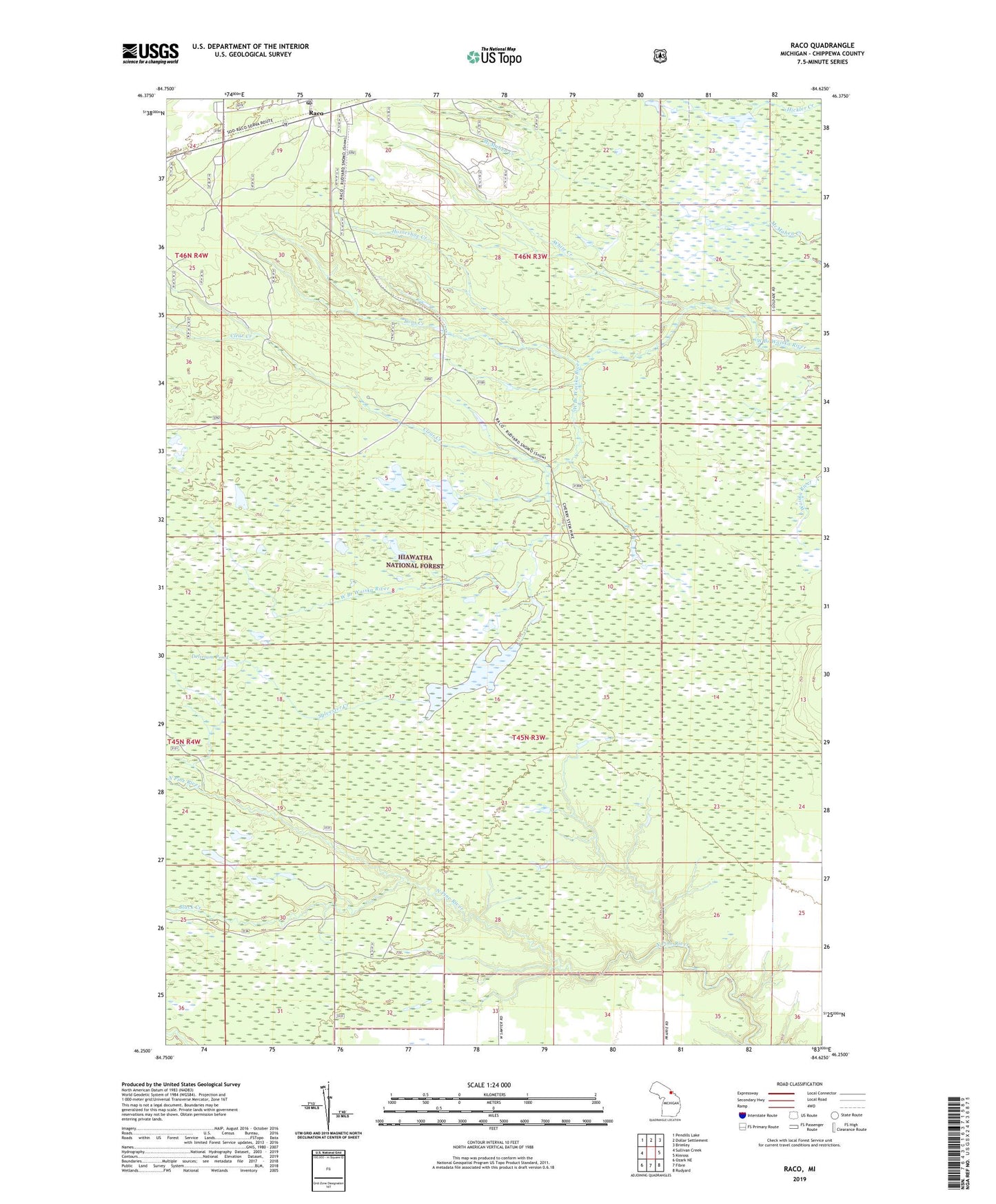
Raco Michigan US Topo Map
Couldn't load pickup availability
Also explore the Raco Forest Service Topo of this same quad for updated USFS data
2023 topographic map quadrangle Raco in the state of Michigan. Scale: 1:24000. Based on the newly updated USGS 7.5' US Topo map series, this map is in the following counties: Chippewa. The map contains contour data, water features, and other items you are used to seeing on USGS maps, but also has updated roads and other features. This is the next generation of topographic maps. Printed on high-quality waterproof paper with UV fade-resistant inks.
Quads adjacent to this one:
West: Sullivan Creek
Northwest: Pendills Lake
North: Dollar Settlement
Northeast: Brimley
East: Kinross
Southeast: Rudyard
South: Fibre
Southwest: Ozark NE
This map covers the same area as the classic USGS quad with code o46084c6.
Contains the following named places: Black Creek, Bons Creek, Camp Bearborn, Charter Township of Kinross, Clear Creek, Delirium Pond, Delirium Wilderness, Horseshoe Creek, Prey Creek, Raco Post Office, Raco Ranger Station, Raco Station, Squirrel Tail Inn, Sylvester Creek, Sylvester Impoundment, White Creek