
MyTopo
Palmer Michigan US Topo Map
Couldn't load pickup availability
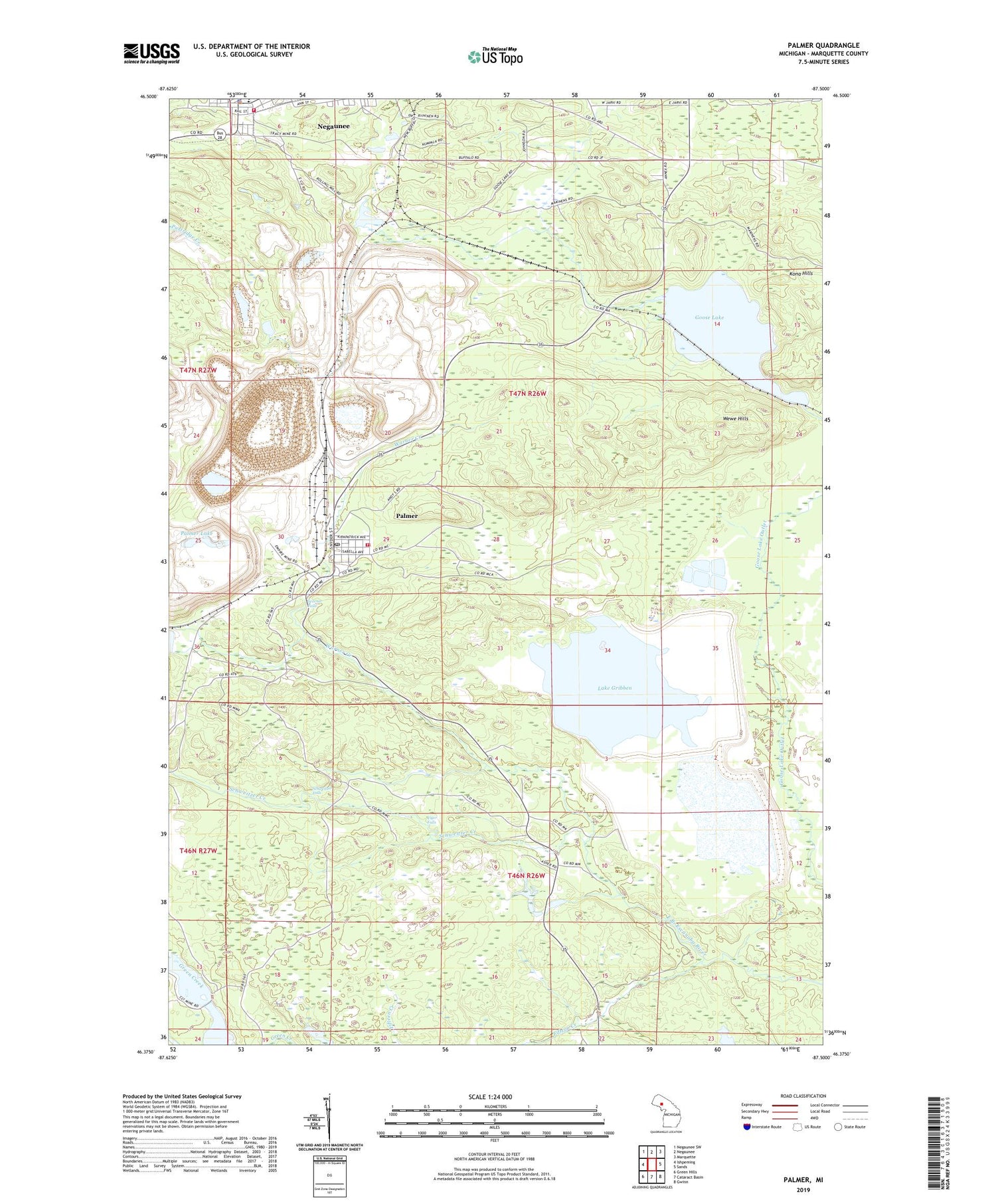
2019 topographic map quadrangle Palmer in the state of Michigan. Scale: 1:24000. Based on the newly updated USGS 7.5' US Topo map series, this map is in the following counties: Marquette. The map contains contour data, water features, and other items you are used to seeing on USGS maps, but also has updated roads and other features. This is the next generation of topographic maps. Printed on high-quality waterproof paper with UV fade-resistant inks.
Quads adjacent to this one:
West: Ishpeming
Northwest: Negaunee SW
North: Negaunee
Northeast: Marquette
East: Sands
Southeast: Gwinn
South: Cataract Basin
Southwest: Green Hills
Contains the following named places: Athens Mine, Breitung Park, Buffalo Hills Playground, City of Negaunee, Episcopal Church of Saint Johns, Fifteen Creek, Finnish Church, Goose Lake, Jackson Park, Jamros Airport, Kona Hills, Lake Gribben, Lucy Hill Naturbahn Luge Track, Negaunee, Negaunee City Library, Negaunee Police Department, Negaunee Volunteer Fire Department, New Richmond Mine, New Volunteer Mine, Old Richmond Mine, Our Lady of Perpetual Help Catholic Church, Palmer, Palmer Census Designated Place, Palmer Lake, Palmer Post Office, Palmer Station, Palmer-Suomi Lutheran Parish, Richmond Township Fire Department / Richmond Township Emergency Medical Services, Richmond Township Library, Schweitzer Creek, Schweitzer Falls, Standard School, Tiger Falls, Township of Richmond, Tracy Mine, Warner Creek, Warner Falls, Wewe Hills, WMQT-FM (Ishpeming), ZIP Code: 49871


