MyTopo
Westphalia Michigan US Topo Map
Couldn't load pickup availability
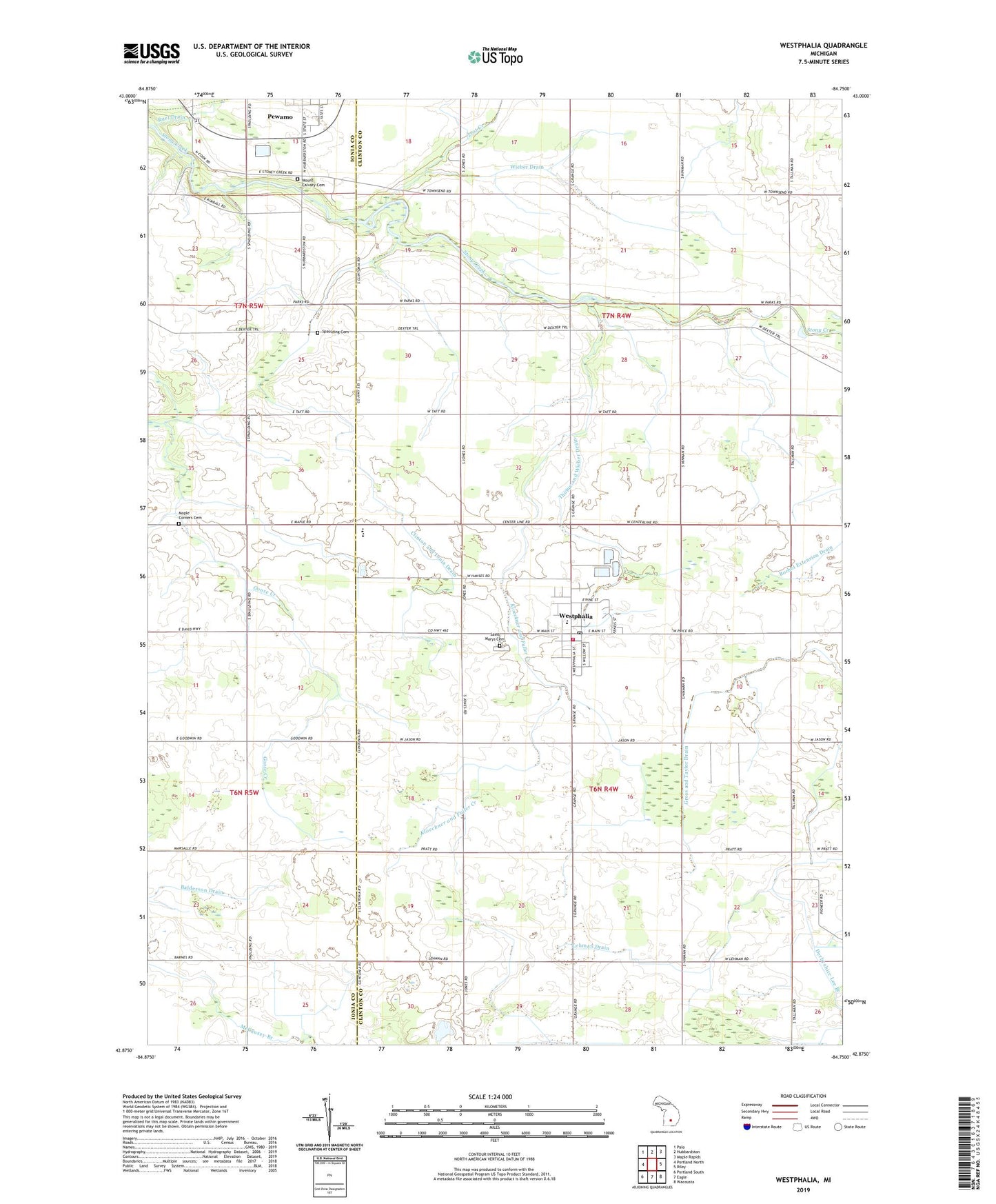
2023 topographic map quadrangle Westphalia in the state of Michigan. Scale: 1:24000. Based on the newly updated USGS 7.5' US Topo map series, this map is in the following counties: Clinton, Ionia. The map contains contour data, water features, and other items you are used to seeing on USGS maps, but also has updated roads and other features. This is the next generation of topographic maps. Printed on high-quality waterproof paper with UV fade-resistant inks.
Quads adjacent to this one:
West: Portland North
Northwest: Palo
North: Hubbardston
Northeast: Maple Rapids
East: Riley
Southeast: Wacousta
South: Eagle
Southwest: Portland South
This map covers the same area as the classic USGS quad with code o42084h7.
Contains the following named places: Arens Brothers Dairy Farm, Brandilyn Farm, Clinton and Ionia Drain, Cook Drain, County Line Dairy, E R Dairy Farm, Gross and Taylor Drain, Havengreen Organic Dairy, Hengesbach Farms, Hufnagel Dairy, Kloeckner and Fuller Creek, Lehman Drain, Lost Creek, Maple Corners Cemetery, Morris Drain, Mount Calvary Cemetery, Nurenberg Farms, Oak View Farm, Pewamo-Westphalia Community School, Platte Farms, Saint Mary's Catholic Church, Saint Marys Cemetery, Saint Mary's Parish Historical Marker, Saint Mary's School, Schafer Farms, Spaulding Cemetery, Thelen Farms, Thome and Wieber Drain, Township of Dallas, Township of Westphalia, Village of Westphalia, Westphalia, Westphalia Post Office, Westphalia Settlement Historical Marker, Westphalia Township Fire Department, Wieber Drain, ZIP Codes: 48873, 48894