MyTopo
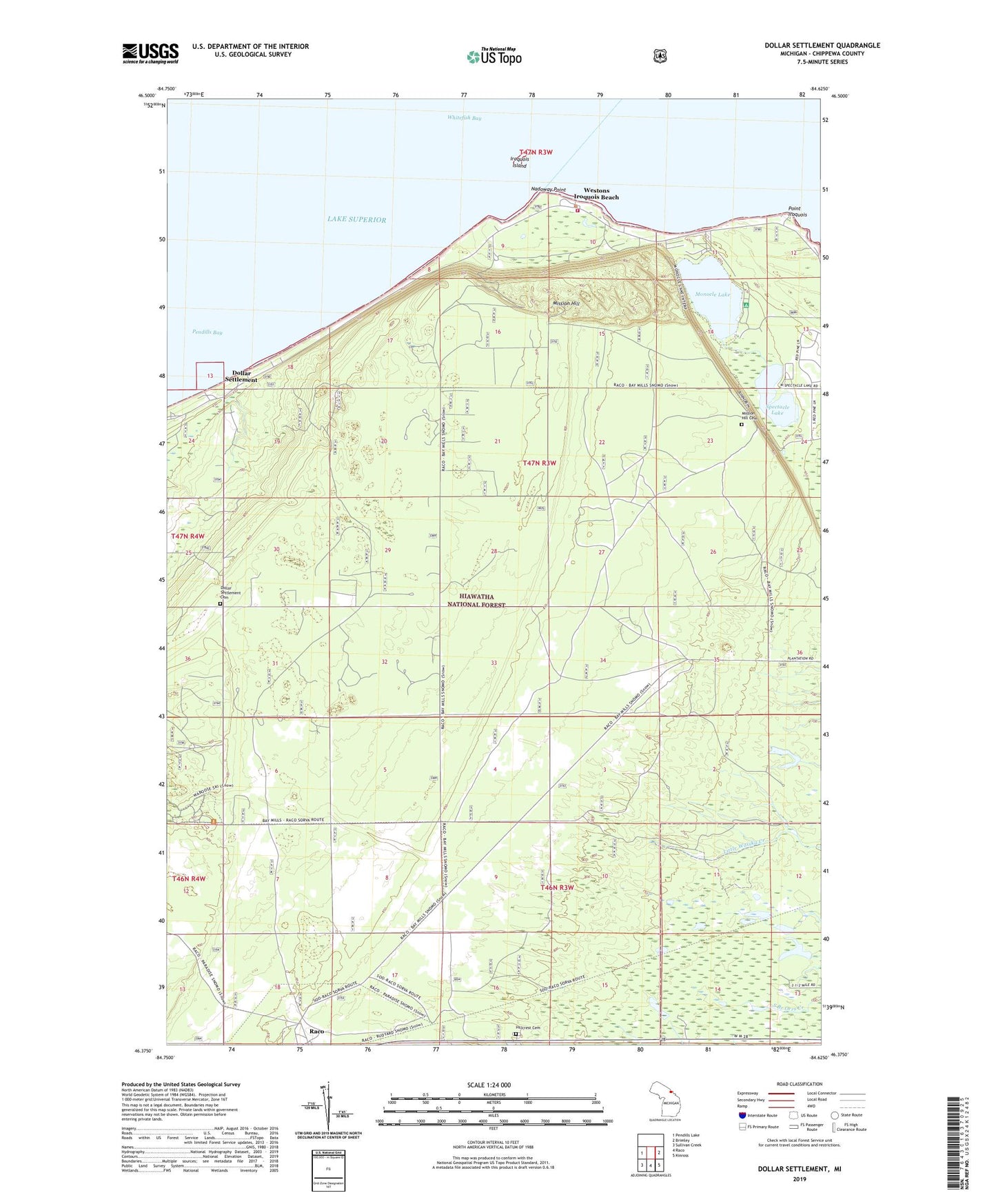
Dollar Settlement Michigan US Topo Map
Couldn't load pickup availability
Also explore the Dollar Settlement Forest Service Topo of this same quad for updated USFS data
2023 topographic map quadrangle Dollar Settlement in the state of Michigan. Scale: 1:24000. Based on the newly updated USGS 7.5' US Topo map series, this map is in the following counties: Chippewa. The map contains contour data, water features, and other items you are used to seeing on USGS maps, but also has updated roads and other features. This is the next generation of topographic maps. Printed on high-quality waterproof paper with UV fade-resistant inks.
Quads adjacent to this one:
West: Pendills Lake
East: Brimley
Southeast: Kinross
South: Raco
Southwest: Sullivan Creek
This map covers the same area as the classic USGS quad with code o46084d6.
Contains the following named places: Bay Mills Township Fire Department, Dollar Settlement, Dollar Settlement Cemetery, Hillcrest Cemetery, Iroquois Island, Iroquois Mountain Ski Area, Iroquois Post Office, Lake Shore Ski Club, Mission Hill, Mission Hill Cemetery, Monocle Lake, Monocle Lake Campground, Nadoway Point, Point Iroquois, Raco, Spectacle Lake, Township of Superior, United States Department of Agriculture Iroquois Light House, Wellsburg Post Office, Westons Iroquois Beach, ZIP Code: 49715