MyTopo
Pickford Michigan US Topo Map
Couldn't load pickup availability
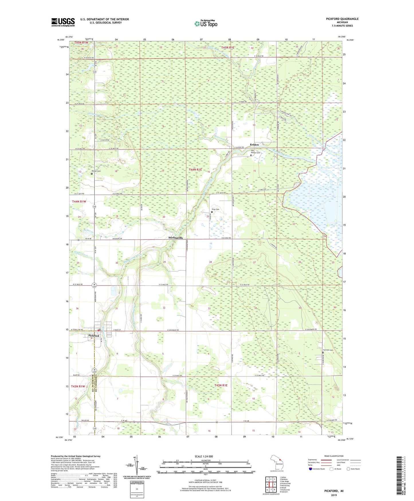
2019 topographic map quadrangle Pickford in the state of Michigan. Scale: 1:24000. Based on the newly updated USGS 7.5' US Topo map series, this map is in the following counties: Chippewa, Mackinac. The map contains contour data, water features, and other items you are used to seeing on USGS maps, but also has updated roads and other features. This is the next generation of topographic maps. Printed on high-quality waterproof paper with UV fade-resistant inks.
Quads adjacent to this one:
West: Pickford NW
Northwest: Dafter
North: Barbeau
Northeast: Oak Ridge
East: Munuscong
Southeast: Stalwart
South: Pickford SE
Southwest: Hessel
Contains the following named places: Bethel Cemetery, Demoreux Creek, East Branch Munuscong River, Fairview Cemetery, Gray Cemetery, Kelden, Kelden Post Office, Little Munuscong River, Munuscong Golf Course, Munuscong River, Munuscong State Forest Campgrounds, Old Keldon Cemetery, Parker Creek, Pickford, Pickford Church of the Nazarene, Pickford Community Park, Pickford Medical Center, Pickford Post Office, Pickford Presbyterian Church, Pickford Public Schools, Pickford Township Hall, Pickford Township Park, Pickford Township Volunteer Fire Department / Volunteer Ambulance Corporation, Saint Mathias Church, Sanderson Creek, School Creek, Stirlingville, Stirlingville Post Office, Taylor Creek, Tone Post Office, Township of Pickford, United Methodist Church, ZIP Code: 49774