MyTopo
Riley Michigan US Topo Map
Couldn't load pickup availability
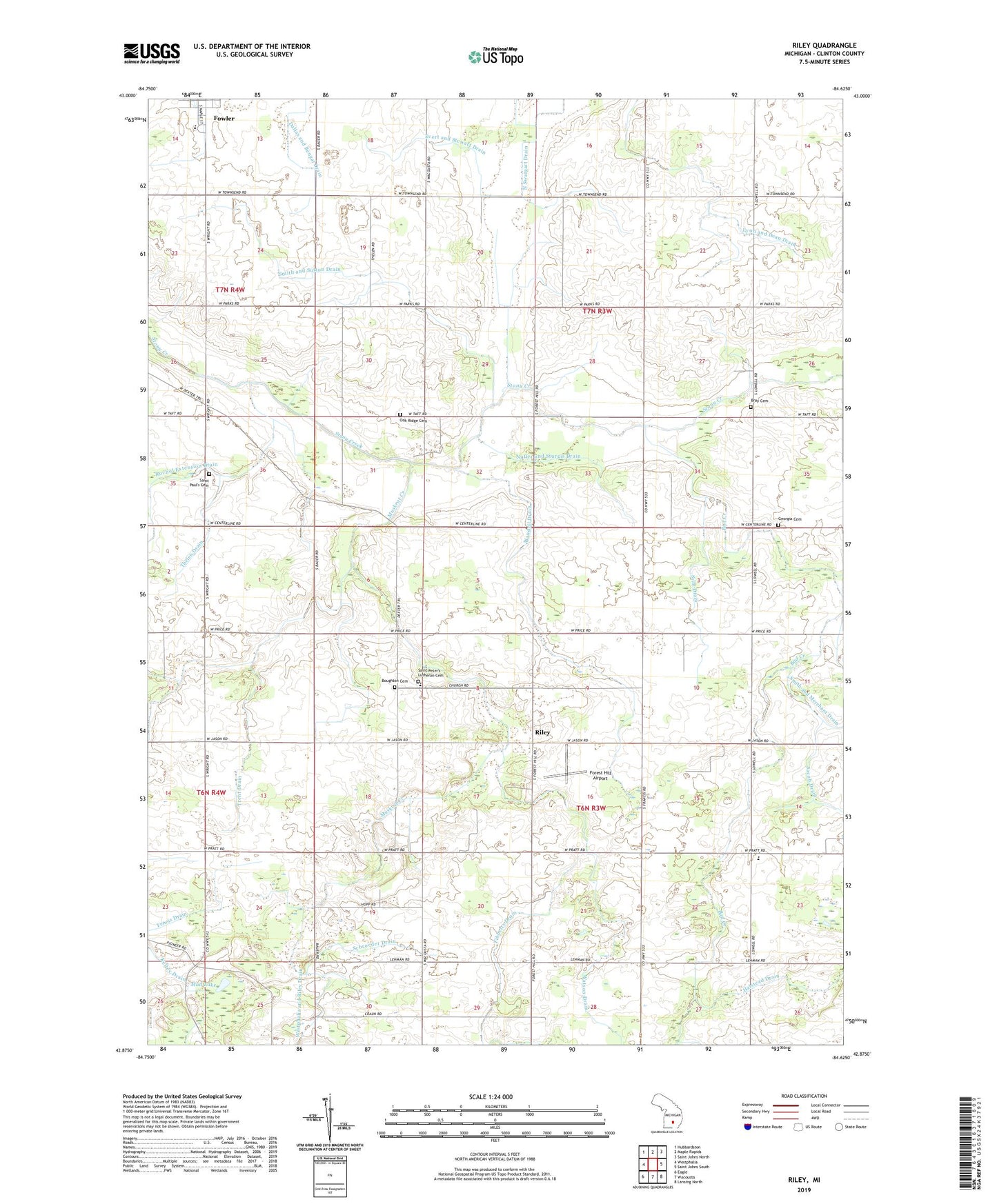
2023 topographic map quadrangle Riley in the state of Michigan. Scale: 1:24000. Based on the newly updated USGS 7.5' US Topo map series, this map is in the following counties: Clinton. The map contains contour data, water features, and other items you are used to seeing on USGS maps, but also has updated roads and other features. This is the next generation of topographic maps. Printed on high-quality waterproof paper with UV fade-resistant inks.
Quads adjacent to this one:
West: Westphalia
Northwest: Hubbardston
North: Maple Rapids
Northeast: Saint Johns North
East: Saint Johns South
Southeast: Lansing North
South: Wacousta
Southwest: Eagle
This map covers the same area as the classic USGS quad with code o42084h6.
Contains the following named places: Anne Char Farms, Bad Creek, Bengal Center School, Bengal Post Office, Boughton Cemetery, Bray Cemetery, Circle K Farm and Ranch, Cloverbrook Farm, Double M Farm, Evert and Stewart Drain, Feneis Drain, Flegler Farms, Forest Hill Airport, Fowler High School, Georgia Cemetery, Granger Drain, Halstead Drain, Harper School, Jacob Drain, Jason Corners Farm, Kelley Drain, Lyon and Dean Drain, M M Farms, Mud Lake, Muskrat Creek, Nuffer and Sturgis Drain, Oak Ridge Cemetery, Oral Post Office, Riley, Riley Elementary School, Riley Post Office, Rochol Extension Drain, Rock N Oak Dairy, Saint Paul's Cemetery, Saint Peter Lutheran Church, Saint Peter's Lutheran Cemetery, Saint Peters School, Schneider Dairy Farm, Schrader Dairy, Schrader Farm, Schroeder Drain, Silm Drain, Smith and Sutton Drain, Sweetgrass Farm, Thelen Drain, Tibbetts Drain, Township of Bengal, Township of Riley, Trent Drain, Vacottage Heliport, Wandeil Drain, Watson Drain, Westphalia and Riley Drain