MyTopo
Eagle Michigan US Topo Map
Couldn't load pickup availability
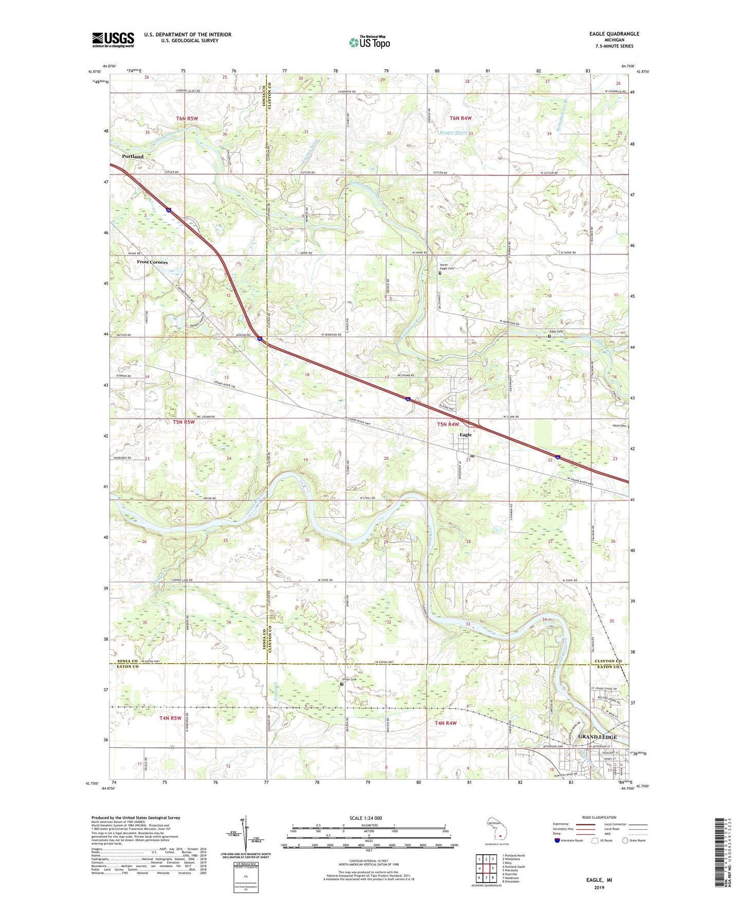
2023 topographic map quadrangle Eagle in the state of Michigan. Scale: 1:24000. Based on the newly updated USGS 7.5' US Topo map series, this map is in the following counties: Clinton, Ionia, Eaton. The map contains contour data, water features, and other items you are used to seeing on USGS maps, but also has updated roads and other features. This is the next generation of topographic maps. Printed on high-quality waterproof paper with UV fade-resistant inks.
Quads adjacent to this one:
West: Portland South
Northwest: Portland North
North: Westphalia
Northeast: Riley
East: Wacousta
Southeast: Dimondale
South: Needmore
Southwest: Hoytville
This map covers the same area as the classic USGS quad with code o42084g7.
Contains the following named places: Church of the Nazarene, Derbyshire Lee Branch, Eagle, Eagle Foursquare Gospel Church, Eagle Post Office, Eagle Station, Eagle United Methodist Church, Eagle Wesley Chapel, Eddy Cemetery, Fitzgerald Park, Fitzgerald Park Historical Marker, Frayer Creek, Frost Corners, Grand Ledge Ravines Mobile Home Park, Hope Lutheran Church, Huhn Farms, Johnson Drain, Joshua Simmons II Historical Marker, Kramer Drain, Ledge Meadows Golf Course, Liberty Church, Lincoln Brick Park, McCausey Branch, Miller Pit, North Eagle Cemetery, North Eagle Post Office, Oak Park, P and H Farms, Portland Rest Area, River Bend Post Office, Sandstone Creek, T C Holbrook Elementary School, Township of Eagle, Union Cemetery, Union Church, Village of Eagle, ZIP Code: 48822