MyTopo
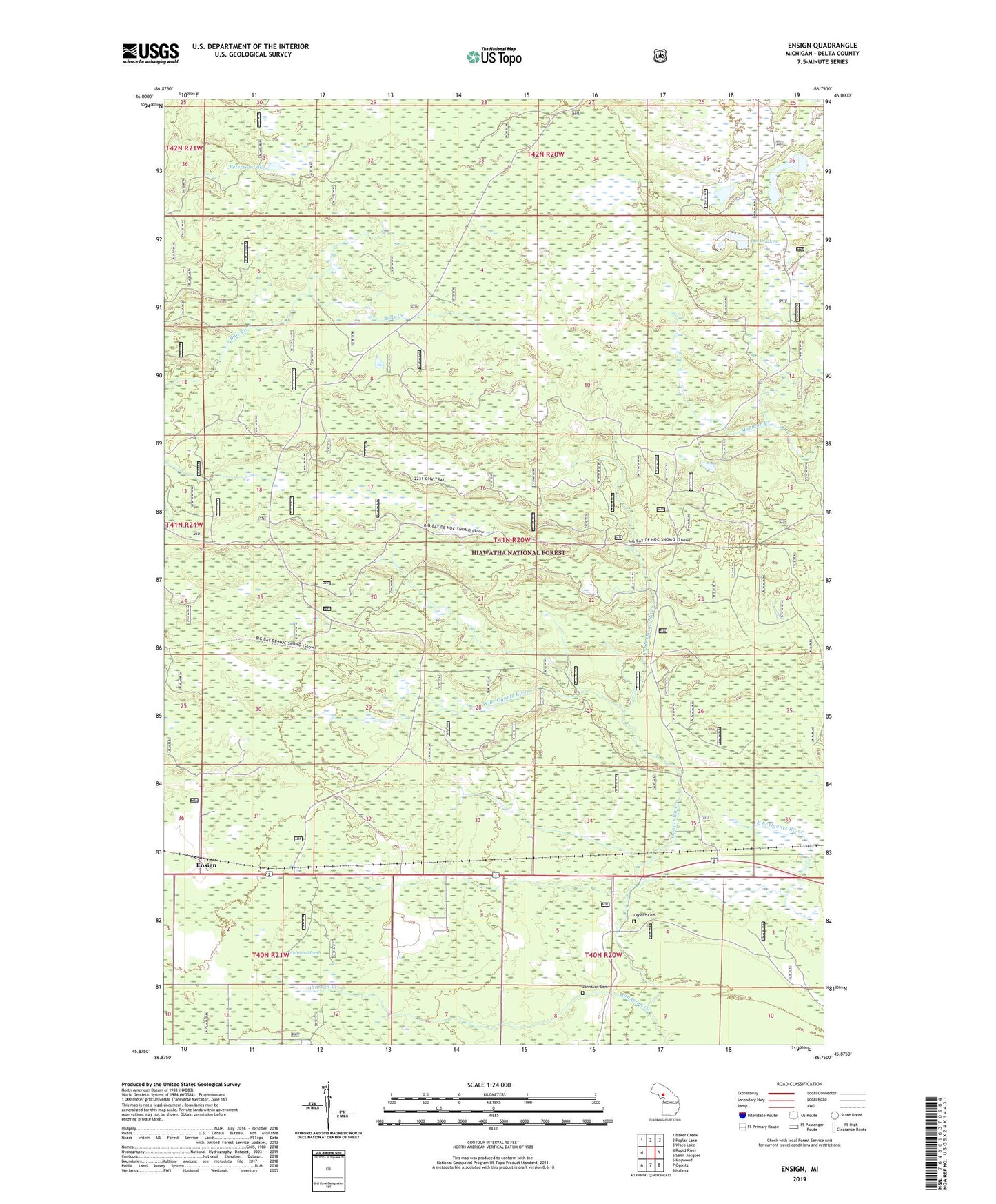
Ensign Michigan US Topo Map
Couldn't load pickup availability
Also explore the Ensign Forest Service Topo of this same quad for updated USFS data
2023 topographic map quadrangle Ensign in the state of Michigan. Scale: 1:24000. Based on the newly updated USGS 7.5' US Topo map series, this map is in the following counties: Delta. The map contains contour data, water features, and other items you are used to seeing on USGS maps, but also has updated roads and other features. This is the next generation of topographic maps. Printed on high-quality waterproof paper with UV fade-resistant inks.
Quads adjacent to this one:
West: Rapid River
Northwest: Baker Creek
North: Poplar Lake
Northeast: Waco Lake
East: Saint Jacques
Southeast: Nahma
South: Ogontz
Southwest: Maywood
This map covers the same area as the classic USGS quad with code o45086h7.
Contains the following named places: East Branch Ogontz River, Ensign, Ensign Post Office, Ensign Station, Johnston Cemetery, Johnston Creek, Lost Lakes, Malman Marsh, North Branch Ogontz River, Ogontz Cemetery, Ogontz Visitor Information Station, Peterson Lake, Ramsey Lake, West Branch Ogontz River, ZIP Code: 49878