MyTopo
Hetherton Michigan US Topo Map
Couldn't load pickup availability
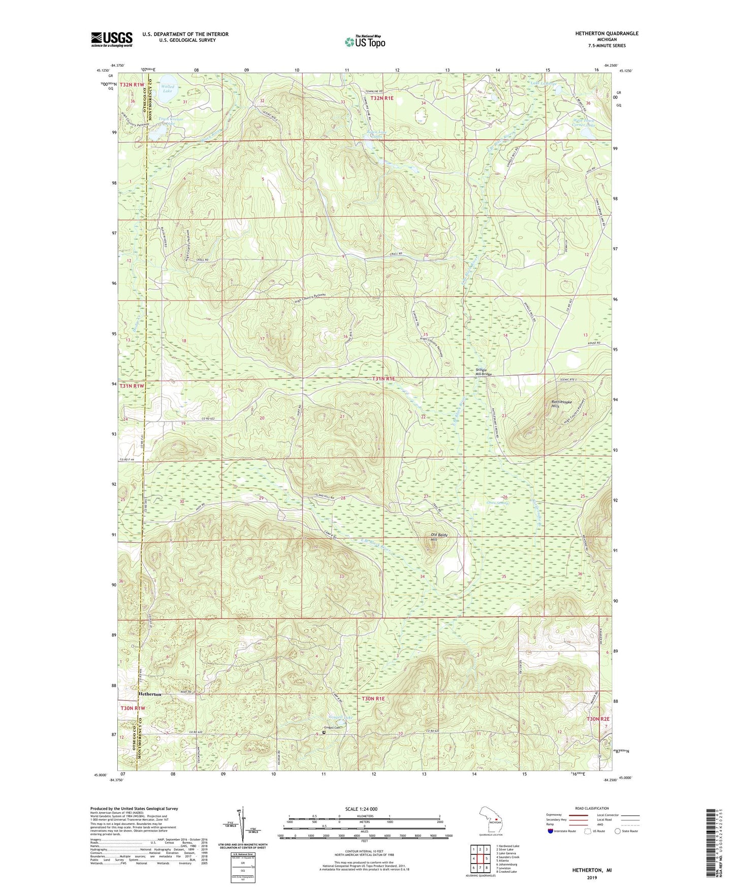
2023 topographic map quadrangle Hetherton in the state of Michigan. Scale: 1:24000. Based on the newly updated USGS 7.5' US Topo map series, this map is in the following counties: Montmorency, Otsego. The map contains contour data, water features, and other items you are used to seeing on USGS maps, but also has updated roads and other features. This is the next generation of topographic maps. Printed on high-quality waterproof paper with UV fade-resistant inks.
Quads adjacent to this one:
West: Saunders Creek
Northwest: Hardwood Lake
North: Silver Lake
Northeast: Lake Geneva
East: Atlanta
Southeast: Crooked Lake
South: Lewiston
Southwest: Johannesburg
This map covers the same area as the classic USGS quad with code o45084a3.
Contains the following named places: Gingell Cemetery, Gingell Lake, Green Swamp, Hetherton, Hetherton Post Office, Hodge Creek, Kissipee Post Office, Kissipee Station, Lake LaBarge, Old Baldy Hill, Rattlesnake Creek, Rattlesnake Hills, Shingle Mill Bridge, Town Corner Lake, Town Corner Lake State Forest Campground, Town Line Lakes, Township of Vienna, Tubbs Creek, WAIR-FM (Atlanta), Walled Lake, West Town Corner Lake