MyTopo
Sears Michigan US Topo Map
Couldn't load pickup availability
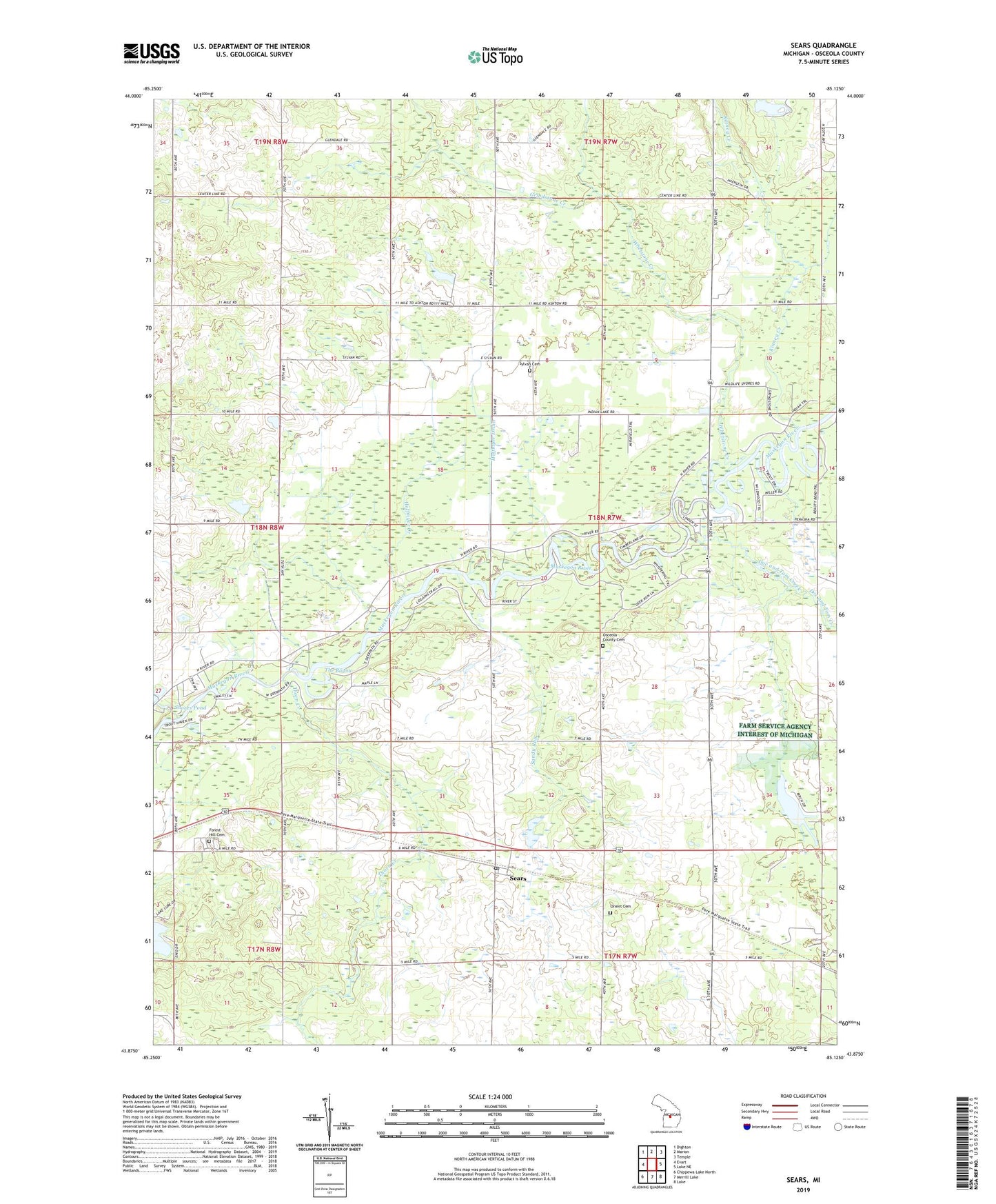
2019 topographic map quadrangle Sears in the state of Michigan. Scale: 1:24000. Based on the newly updated USGS 7.5' US Topo map series, this map is in the following counties: Osceola. The map contains contour data, water features, and other items you are used to seeing on USGS maps, but also has updated roads and other features. This is the next generation of topographic maps. Printed on high-quality waterproof paper with UV fade-resistant inks.
Quads adjacent to this one:
West: Evart
Northwest: Dighton
North: Marion
Northeast: Temple
East: Lake NE
Southeast: Lake
South: Merrill Lake
Southwest: Chippewa Lake North
Contains the following named places: Birch Valley Golf Course, Brooks School, Chippewa Creek, Church of God, Crawford Park, Doc and Tom Creek, Evangelical Church, Faith Church, Forest Hill Cemetery, Grindstone Creek, Hoffmyer Creek, Hoffmyer Drain, Kingdom Hall, Kinney Creek, Michigan Department of Natural Resources Evart Field Office, Ogilvie School, Ogilvie Wesleyan Church, Orient Cemetery, Orient Township Hall, Osceola County Cemetery, River Country Campground, Sandy Run, Sears, Sears Post Office, Sears Station, Shores Pond, Sylvan Cemetery, Sylvan School, Sylvan Township Hall, The Bayou, Thorn Creek, Township of Sylvan, United Church, Whetstone Creek, Woods Lake, ZIP Code: 49679