MyTopo
Evart Michigan US Topo Map
Couldn't load pickup availability
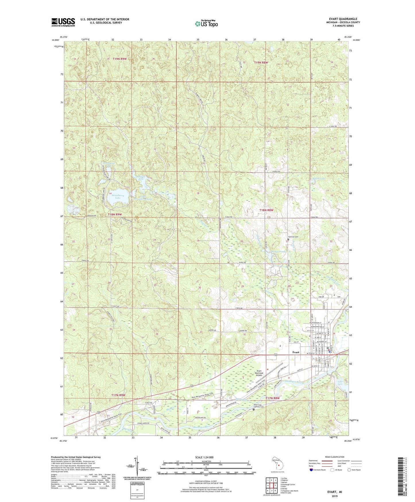
2023 topographic map quadrangle Evart in the state of Michigan. Scale: 1:24000. Based on the newly updated USGS 7.5' US Topo map series, this map is in the following counties: Osceola. The map contains contour data, water features, and other items you are used to seeing on USGS maps, but also has updated roads and other features. This is the next generation of topographic maps. Printed on high-quality waterproof paper with UV fade-resistant inks.
Quads adjacent to this one:
West: Slaybaugh Corner
Northwest: Le Roy
North: Dighton
Northeast: Marion
East: Sears
Southeast: Merrill Lake
South: Chippewa Lake North
Southwest: Hersey
This map covers the same area as the classic USGS quad with code o43085h3.
Contains the following named places: Big Stone Creek, Calvary Baptist Church, Chippewa River State Forest, City of Evart, Crossroads Community Church, Decker Ponds, Evangel Church, Evangelical Church, Evart, Evart Elementary School, Evart High School, Evart Middle School, Evart Municipal Airport, Evart Police Department, Evart Post Office, Evart Public Library, Evart Station, Evart United Methodist Church, Evart Volunteer Fire Department, First Baptist Church of Evart, Free Methodist Church, German Cemetery, Hartwick Lookout Tower, Holy Cross Catholic Cemetery, Horsehead Lake, Joseph W Guyton Historical Marker, Lake Lure, Little Strawberry Lake, Mid-Michigan Medical Center, Missionary Church, Morgan Lake, Mud Creek, Myrtle Lake, North Evart United Methodist Church Historical Marker, Osceola County, Posted Creek, Riverside City Park, Sacred Heart Church, Saint Paul's Lutheran Church, Shores Pond, Spectrum Health Evart Clinic, Spring Hill Camp, Spring Lake, Strawberry Lake, Thompson Creek, Township of Osceola, Twin Creek, Warson School, Whitmore Pond, ZIP Code: 49631