MyTopo
Secord Lake Michigan US Topo Map
Couldn't load pickup availability
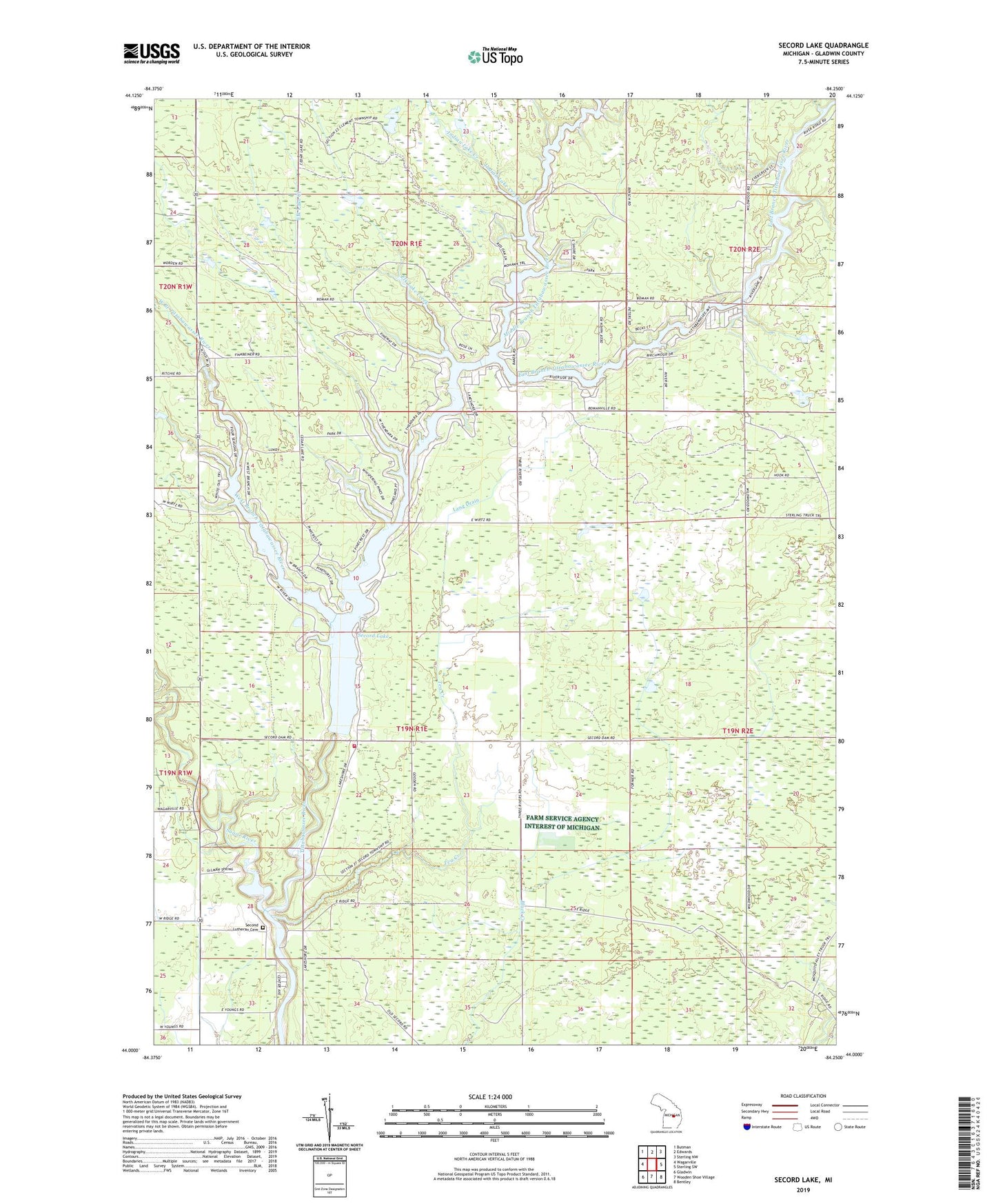
2023 topographic map quadrangle Secord Lake in the state of Michigan. Scale: 1:24000. Based on the newly updated USGS 7.5' US Topo map series, this map is in the following counties: Gladwin. The map contains contour data, water features, and other items you are used to seeing on USGS maps, but also has updated roads and other features. This is the next generation of topographic maps. Printed on high-quality waterproof paper with UV fade-resistant inks.
Quads adjacent to this one:
West: Wagarville
Northwest: Butman
North: Edwards
Northeast: Sterling NW
East: Sterling SW
Southeast: Bentley
South: Wooden Shoe Village
Southwest: Gladwin
This map covers the same area as the classic USGS quad with code o44084a3.
Contains the following named places: Avery Creek, East Branch Tittabawassee River, Elk Lake Creek, Indian Lake Creek, Koll Drain, Lang Drain, Middle Branch Tittabawassee River, Sampson Drain, Second Lutheran Cemetery, Second Post Office, Secord, Secord Church, Secord Lake, Secord Lake Campground, Secord Township Fire Rescue, Sugar River, Tea Creek, Township of Clement, Township of Secord, West Branch Tittabawassee River, Wildwood Campground, Wildwood Fire Department