MyTopo
Edwards Michigan US Topo Map
Couldn't load pickup availability
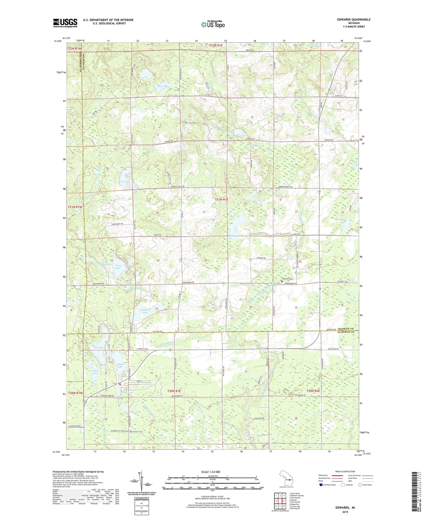
2023 topographic map quadrangle Edwards in the state of Michigan. Scale: 1:24000. Based on the newly updated USGS 7.5' US Topo map series, this map is in the following counties: Ogemaw, Gladwin, Roscommon. The map contains contour data, water features, and other items you are used to seeing on USGS maps, but also has updated roads and other features. This is the next generation of topographic maps. Printed on high-quality waterproof paper with UV fade-resistant inks.
Quads adjacent to this one:
West: Butman
Northwest: Saint Helen
North: Ogemaw Springs
Northeast: West Branch
East: Sterling NW
Southeast: Sterling SW
South: Secord Lake
Southwest: Wagarville
This map covers the same area as the classic USGS quad with code o44084b3.
Contains the following named places: Cedar Lake, Chatman Creek, Chatman Lake, Circle K Farms, Clement Township Fire Department, Dollar Lake, Edward Post Office, Edwards, Edwards Cemetery, Edwards Church, Edwards Creek, Edwards Lake, Elk Lake, Frost Lake, Gear Lake, Indian Lake, Little Frost Lake, Mansfield Creek, Mount Zion Tabernacle Church, Mud Lake, New Life Christian Church, Oak Grove Church, Parren Creek, Perrys Creek, Ray Creek, Tee Lake, Township of Edwards