MyTopo
Butman Michigan US Topo Map
Couldn't load pickup availability
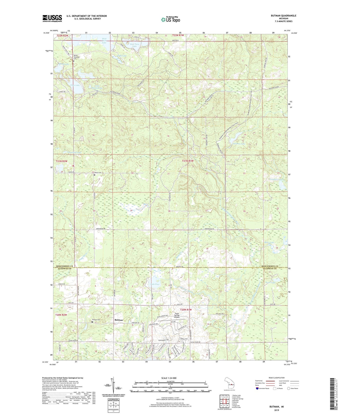
2023 topographic map quadrangle Butman in the state of Michigan. Scale: 1:24000. Based on the newly updated USGS 7.5' US Topo map series, this map is in the following counties: Roscommon, Gladwin. The map contains contour data, water features, and other items you are used to seeing on USGS maps, but also has updated roads and other features. This is the next generation of topographic maps. Printed on high-quality waterproof paper with UV fade-resistant inks.
Quads adjacent to this one:
West: Meredith
Northwest: Backus Lake
North: Saint Helen
Northeast: Ogemaw Springs
East: Edwards
Southeast: Secord Lake
South: Wagarville
Southwest: Skeels
This map covers the same area as the classic USGS quad with code o44084b4.
Contains the following named places: Butman, Butman Cemetery, Butman Post Office, Campbell Lake, Clear Lake, Coan Millpond, Dunham Lake, East Twin Lake, Eddy Lake, Knowland Lake, Lake Four, Lake Four Outlet, Little Woods Lake, Lost Creek, Mikes Lake, Muma Creek, Nester Township Cemetery, Nester Township Fire Department, Nester Township Hall, Nolan Cemetery, Nolan Post Office, Nolan Station, Noren Creek, Perch Lake, Spring Lake, Sugar Springs Airpark, Sugar Springs Campground, Sugar Springs Country Club, Township of Nester, Twin Lakes Campground, West Twin Lake, Woods Lake