MyTopo
Sullivan Creek Michigan US Topo Map
Couldn't load pickup availability
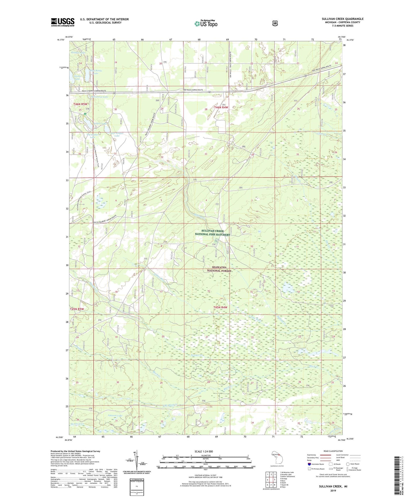
2019 topographic map quadrangle Sullivan Creek in the state of Michigan. Scale: 1:24000. Based on the newly updated USGS 7.5' US Topo map series, this map is in the following counties: Chippewa. The map contains contour data, water features, and other items you are used to seeing on USGS maps, but also has updated roads and other features. This is the next generation of topographic maps. Printed on high-quality waterproof paper with UV fade-resistant inks.
Quads adjacent to this one:
West: Strongs
Northwest: McNearney Lake
North: Pendills Lake
Northeast: Dollar Settlement
East: Raco
Southeast: Fibre
South: Ozark NE
Southwest: Ozark
Contains the following named places: Black Creek Hunting Club, Camp Quiet, Demond Hill Lookout Tower, Dishpan Lake, East Soldier Lake, High Banks Lake, Johnson Lake, Monument Lake, Ol Misery Lodge, Raco Army Air Field, Raco Field, Soldier Lake, Soldier Lake Campground, South Branch Black Creek, Sullivan Creek, Sullivan Creek National Fish Hatchery, Sullivan Creek Picnic Ground, Sweiger Creek, Toy Soldier Lake