MyTopo
Nadeau Michigan US Topo Map
Couldn't load pickup availability
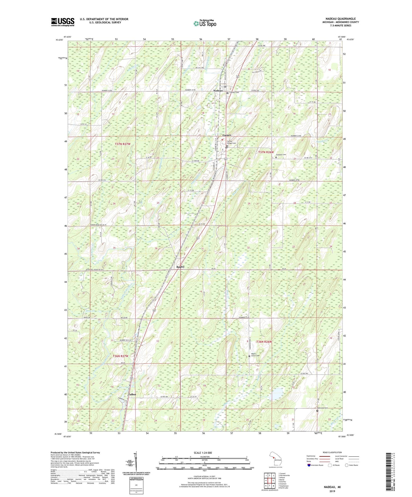
2023 topographic map quadrangle Nadeau in the state of Michigan. Scale: 1:24000. Based on the newly updated USGS 7.5' US Topo map series, this map is in the following counties: Menominee. The map contains contour data, water features, and other items you are used to seeing on USGS maps, but also has updated roads and other features. This is the next generation of topographic maps. Printed on high-quality waterproof paper with UV fade-resistant inks.
Quads adjacent to this one:
West: Banat
Northwest: Cunard
North: Hermansville
Northeast: Wilson
East: Gourley
Southeast: North Lake
South: Stephenson
Southwest: Swanson
This map covers the same area as the classic USGS quad with code o45087e5.
Contains the following named places: Adams Park, Bagley, Bagley Post Office, Bagley Station, Blount Post Office, Boyle Creek, Calvary Cemetery, Carney, Carney Evangelical Free Church, Carney Post Office, Carney Station, Carney Village Cemetery, DeGroote Lake, Holmes Creek, Maple Grove Cemetery, Menominee County, Nadeau, Nadeau Post Office, Nadeau Station, Nadeau Township Fire Department, Oakwood Cemetery, Poterfield Creek, Saint Brunos Catholic Church, Schetter Creek, Snow Creek, Swedish Cemetery, Talbot, Talbot Pond, Talbot Post Office, Talbot Station, Township of Nadeau, Village of Carney, ZIP Codes: 49812, 49863