MyTopo
Thousand Island Lake Michigan US Topo Map
Couldn't load pickup availability
Also explore the Thousand Island Lake Forest Service Topo of this same quad for updated USFS data
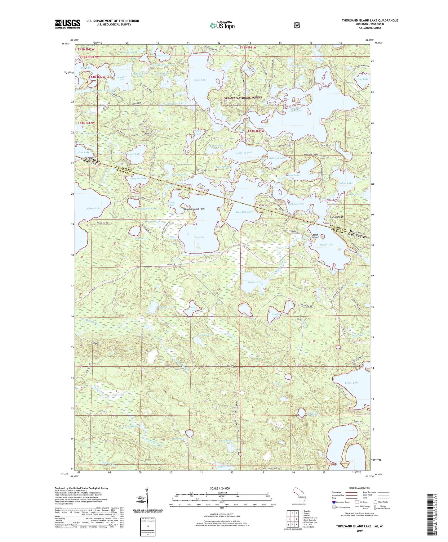
2023 topographic map quadrangle Thousand Island Lake in the states of Wisconsin, Michigan. Scale: 1:24000. Based on the newly updated USGS 7.5' US Topo map series, this map is in the following counties: Gogebic, Vilas. The map contains contour data, water features, and other items you are used to seeing on USGS maps, but also has updated roads and other features. This is the next generation of topographic maps. Printed on high-quality waterproof paper with UV fade-resistant inks.
Quads adjacent to this one:
West: Tenderfoot Lake
Northwest: Gogebic
North: Thayer
Northeast: Beaton
East: Black Oak Lake
Southeast: Stormy Lake
South: Star Lake
Southwest: White Sand Lake
Contains the following named places: Balsam Lake, Bay Lake, Belle Island, Benny Lake, Big Lake, Big Mosquito Lake, Brown Lake, Cedar Lake, Cisco Lake, Cleveland Lake, Coffee Lake, Cox Lake, Crampton Lake, Dalzell Lake, Deadwood Lake, Deerpath Lake, Dream Lake, Dumbbell Lake, Dutch Lake, East Bay Lake, Emeline Lake, Erwin Lake, Fishhawk Lake, Forest Lake, Garland Springs, Gilbert Lake, Grace Lake, Gray Lake, Guides Lake, Hardin Lake, Helen Creek, Helen Lake, Indian Lake, Indian Point, Jane Lake, Jute Lake Lookout Tower, Kickapoo Lake, Kinwamakwad Lake, Lac du Lune, Lake of the Woods, Lindsley Lake, Little Mosquito Lake, Mamie Lake, McCullough Lake, Meadowwoods Point, Michigan Bay, Midget Lake, Morley Lake, Mule Lake, Palmer Bay, Palmer Lake, Perry Lake, Plum Creek, Poor Lake, Spring Creek, Thousand Island Lake, Tower Lake, Town of Land O'Lakes, West Bay Lake, White Spruce Lake, Whitefish Creek