MyTopo
Star Lake Wisconsin US Topo Map
Couldn't load pickup availability
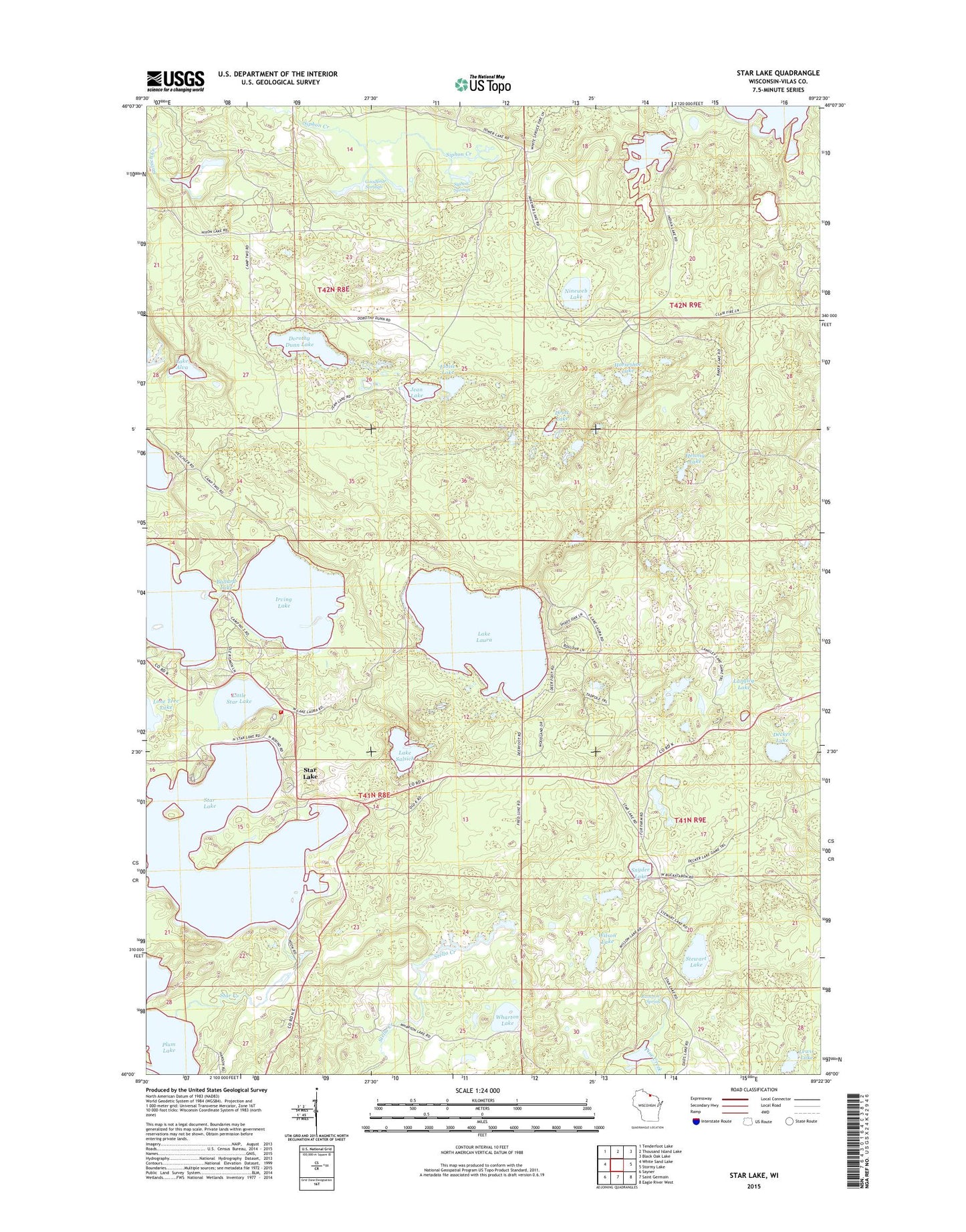
2023 topographic map quadrangle Star Lake in the state of Wisconsin. Scale: 1:24000. Based on the newly updated USGS 7.5' US Topo map series, this map is in the following counties: Vilas. The map contains contour data, water features, and other items you are used to seeing on USGS maps, but also has updated roads and other features. This is the next generation of topographic maps. Printed on high-quality waterproof paper with UV fade-resistant inks.
Quads adjacent to this one:
West: White Sand Lake
Northwest: Tenderfoot Lake
North: Thousand Island Lake
Northeast: Black Oak Lake
East: Stormy Lake
Southeast: Eagle River West
South: Saint Germain
Southwest: Sayner
This map covers the same area as the classic USGS quad with code o46089a4.
Contains the following named places: Ballard Lake, Camp Five Lake, Decker Lake, Dorothy Dunn Lake, Drott Lake, Eloise Lake, Goodyear Springs, Goodyear Springs - East State Natural Area, Hennig Lake, Horseshoe Lake, Indian Lake, Irving Lake, Jean Lake, Lake Alva, Lake Laura, Lake Salsich, Langley Lake, Lewis Lake, Little Star Lake, Monahan Lookout Tower, Nineweb Lake, Pine Lake, Plum Lake Hemlock Forest State Natural Area, Plum Lake Township Volunteer Fire Department Station 2, Rainbow Spring, Siphon Springs, Snyder Lake, Star Creek, Star Lake, Stewart Lake, Town of Plum Lake, Wharton Lake, White Squaw Lake, Wilson Lake