MyTopo
Stormy Lake Wisconsin US Topo Map
Couldn't load pickup availability
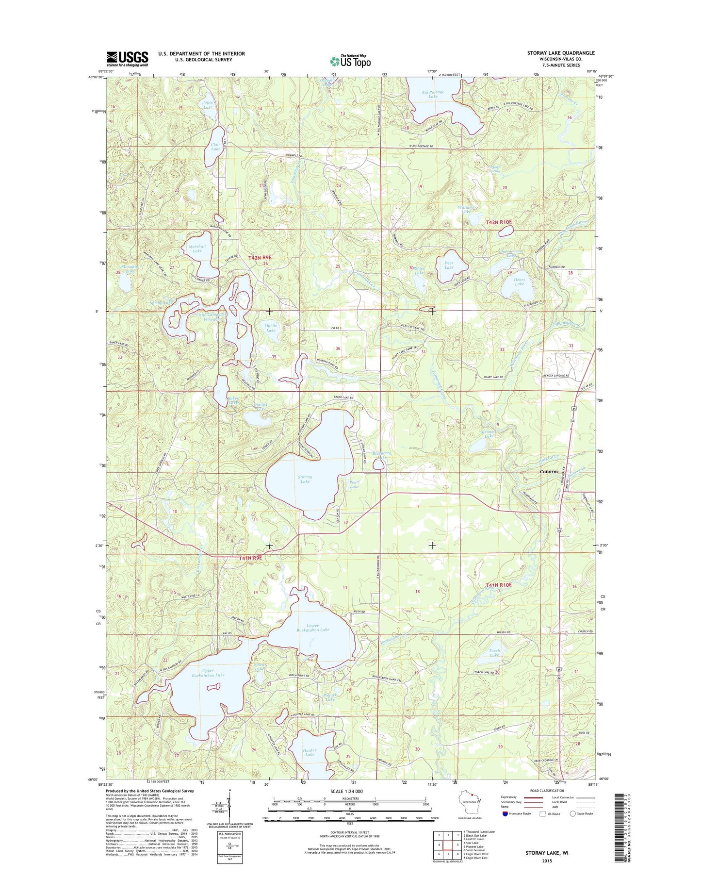
2022 topographic map quadrangle Stormy Lake in the state of Wisconsin. Scale: 1:24000. Based on the newly updated USGS 7.5' US Topo map series, this map is in the following counties: Vilas. The map contains contour data, water features, and other items you are used to seeing on USGS maps, but also has updated roads and other features. This is the next generation of topographic maps. Printed on high-quality waterproof paper with UV fade-resistant inks.
Quads adjacent to this one:
West: Star Lake
Northwest: Thousand Island Lake
North: Black Oak Lake
Northeast: Land O' Lakes
East: Pioneer Lake
Southeast: Eagle River East
South: Eagle River West
Southwest: Saint Germain
This map covers the same area as the classic USGS quad with code o46089a3.
Contains the following named places: 10 Reservoir, 54519, Baker Lake, Bennett Lake, Blueberry Lake, Buckatabon Creek, Buckatahpon 1909c361 Dam, Chamberlain Lake, Clair Lake, Colin Island, Community Park, Conover, Conover Church, Conover Post Office, Covenant Church, Deer Lake, Haymeadow Creek, Heart Lake, Hunter Lake, Joyce Lake, Little Tamarack Creek, Little Tamarack Creek 2WP882 Dam, Little Tamarack Flowage, Lower Buckatabon Lake, Marshall Lake, Monahan Lake, Muskrat Creek, Myrtle Lake, Nudist Lake, Pearl Lake, Pioneer Creek, Pollack Lake, Portage Spring, Ramah Camp, Reiter Lake, Soleit Lake, Spring Lake, Stormy Lake, Tamarack Creek, Torch Lake, Town of Conover, Upper and Lower Buckatabon 14 Rerservoir, Upper Buckatabon Lake, Williams Lake