MyTopo
Ubly Michigan US Topo Map
Couldn't load pickup availability
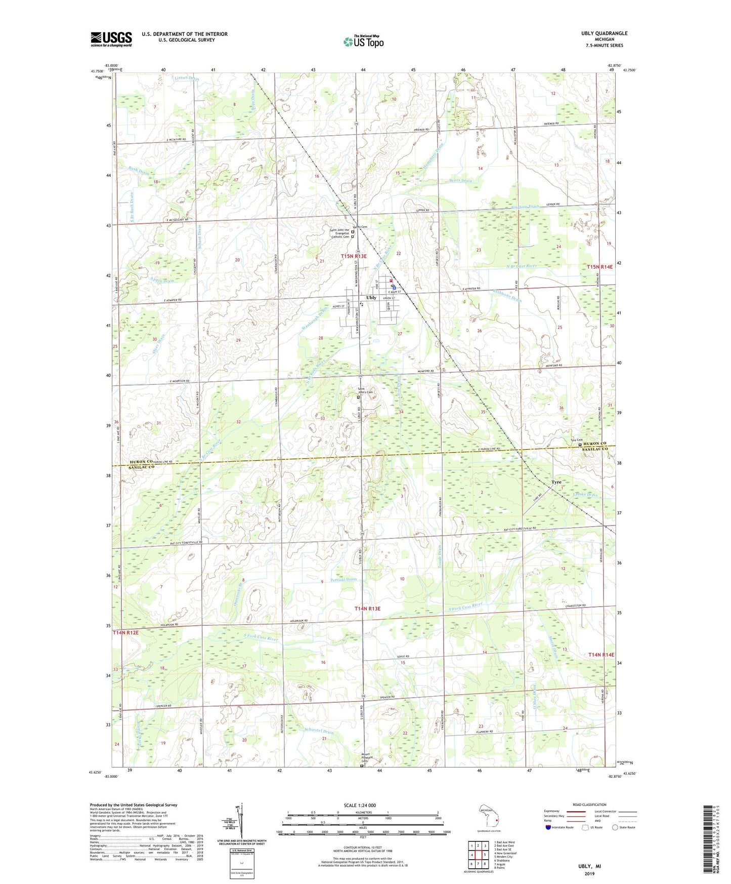
2019 topographic map quadrangle Ubly in the state of Michigan. Scale: 1:24000. Based on the newly updated USGS 7.5' US Topo map series, this map is in the following counties: Huron, Sanilac. The map contains contour data, water features, and other items you are used to seeing on USGS maps, but also has updated roads and other features. This is the next generation of topographic maps. Printed on high-quality waterproof paper with UV fade-resistant inks.
Quads adjacent to this one:
West: New Greenleaf
Northwest: Bad Axe West
North: Bad Axe East
Northeast: Bad Axe SE
East: Minden City
Southeast: Palms
South: Argyle
Southwest: Shabbona
Contains the following named places: Austin Drain, Bingham Drain, Bingham School, Bingham Township Ambulance Service, Bingham Township Fire Department, Bloomington Post Office, Brown Drain, Brumba Park, Byers Drain, Citizens Bank Block Historical Marker, Humphrey Drain, Huron Medical Center Ubly Campus, Janowaik Drain, Lamka Drain, Mount Pleasant Cemetery, Nugent Drain, Old Saint John's Cemetery, Osentoski Branch, O'Shea Drain, Perviski Drain, Rathbone Drain, Rush Drain, Saint John the Evangelist Catholic Cemetery, Saint John's Evangelist Parish, Schant Drain, Schiestel Drain, Sleeper Public Library, South Branch Rush Drain, Sparling Drain, Stanbaugh Drain, Tough Drain, Township of Austin, Township of Bingham, Tyre, Tyre Cemetery, Tyre Drain, Tyre Post Office, Tyre Station, Ubly, Ubly Dragway, Ubly Heights Golf Course, Ubly High School, Ubly Medical Clinic, Ubly Police Department, Ubly Post Office, Ubly Station, Ubly Village Hall, Ubly Village Park, Valley Cemetery, Village of Ubly, WUCX-TV (Bad Axe), ZIP Code: 48475