MyTopo
Walsh Michigan US Topo Map
Couldn't load pickup availability
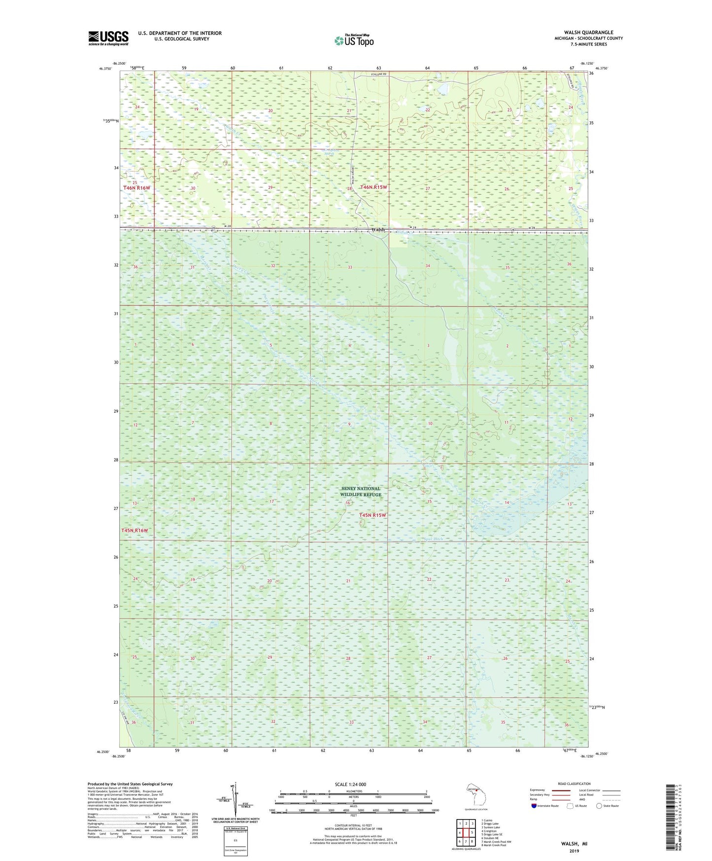
2023 topographic map quadrangle Walsh in the state of Michigan. Scale: 1:24000. Based on the newly updated USGS 7.5' US Topo map series, this map is in the following counties: Schoolcraft. The map contains contour data, water features, and other items you are used to seeing on USGS maps, but also has updated roads and other features. This is the next generation of topographic maps. Printed on high-quality waterproof paper with UV fade-resistant inks.
Quads adjacent to this one:
West: Creighton
Northwest: Cusino
North: Driggs Lake
Northeast: Sunken Lake
East: Driggs Lake SE
Southeast: Marsh Creek Pool
South: Marsh Creek Pool NW
Southwest: Steuben NE
This map covers the same area as the classic USGS quad with code o46086c2.
Contains the following named places: C-Three Pool, Ducey Creek, Seney Wilderness, Spur Ditch, Walsh, Walsh Post Office, Walsh Station