MyTopo
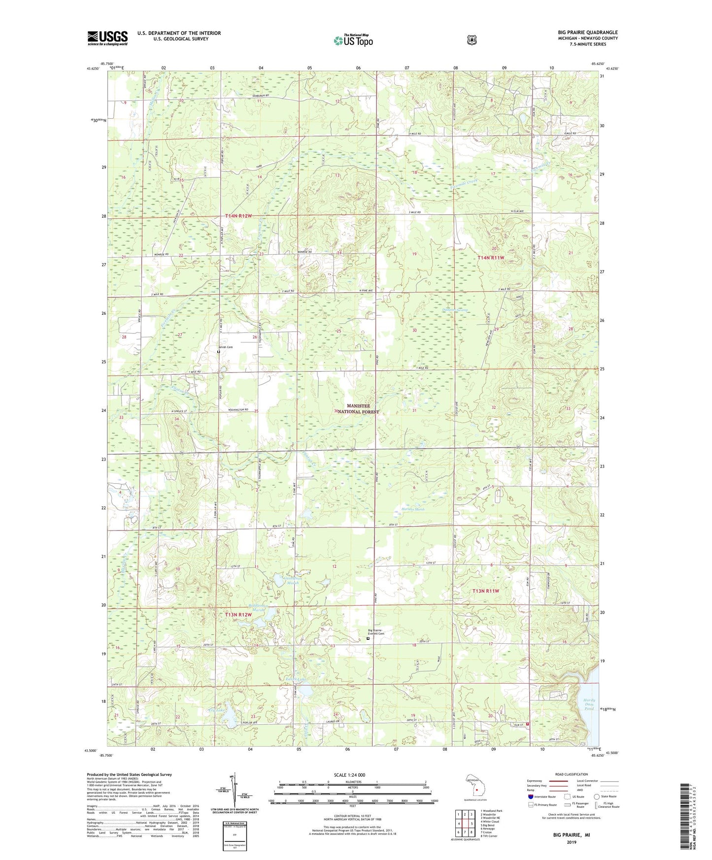
Big Prairie Michigan US Topo Map
Couldn't load pickup availability
Also explore the Big Prairie Forest Service Topo of this same quad for updated USFS data
2023 topographic map quadrangle Big Prairie in the state of Michigan. Scale: 1:24000. Based on the newly updated USGS 7.5' US Topo map series, this map is in the following counties: Newaygo. The map contains contour data, water features, and other items you are used to seeing on USGS maps, but also has updated roads and other features. This is the next generation of topographic maps. Printed on high-quality waterproof paper with UV fade-resistant inks.
Quads adjacent to this one:
West: White Cloud
Northwest: Woodland Park
North: Woodville
Northeast: Woodville NE
East: Big Bend
Southeast: Tift Corner
South: Croton
Southwest: Newaygo
This map covers the same area as the classic USGS quad with code o43085e6.
Contains the following named places: Amish Cemetery, Biddleman Marsh, Big Prairie, Big Prairie - Everett Cemetery, Big Prairie Community Church, Big Prairie Post Office, Big Prairie Township Fire Department, Dudgean Swamp, Eaves Lake, Fields Post Office, Fields Station, Fry Lake, Gibbs Lookout Tower, Gustafson Marsh, Harness Marsh, Holmdale Post Office, Mullen Creek, Sandy Beach Campground, Sandy Beach County Park, Township of Everett, Township of Wilcox, Trumbull Corners, White Cloud Church, ZIP Code: 49349