MyTopo
Woodland Michigan US Topo Map
Couldn't load pickup availability
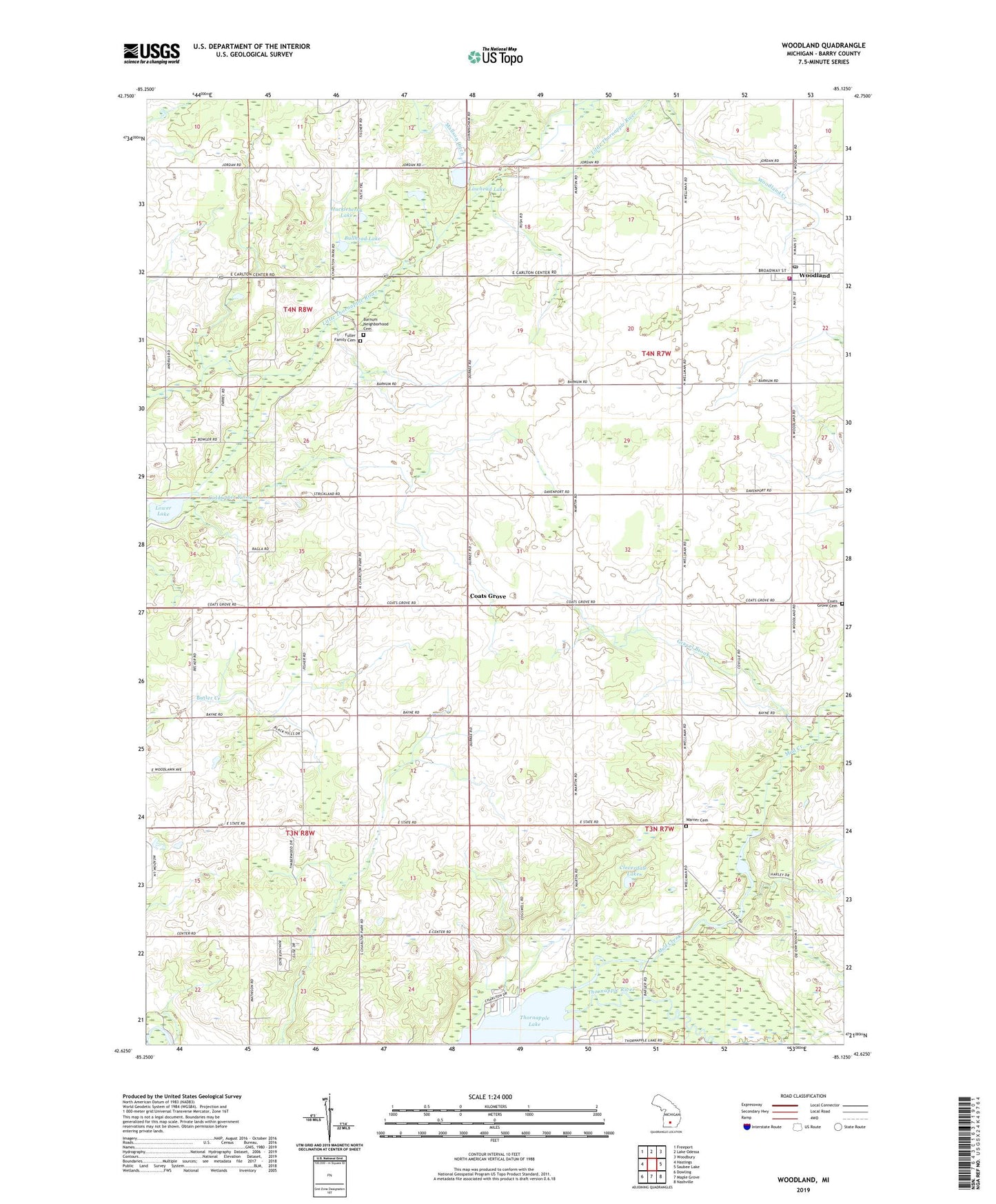
2019 topographic map quadrangle Woodland in the state of Michigan. Scale: 1:24000. Based on the newly updated USGS 7.5' US Topo map series, this map is in the following counties: Barry. The map contains contour data, water features, and other items you are used to seeing on USGS maps, but also has updated roads and other features. This is the next generation of topographic maps. Printed on high-quality waterproof paper with UV fade-resistant inks.
Quads adjacent to this one:
West: Hastings
Northwest: Freeport
North: Lake Odessa
Northeast: Woodbury
East: Saubee Lake
Southeast: Nashville
South: Maple Grove
Southwest: Dowling
Contains the following named places: Barnum Neighborhood Cemetery, Brethren Church, Bullhead Lake, Charter Township of Hastings, Coats Grove, Coats Grove Cemetery, Coats Grove Post Office, Coats Grove Station, Fisher School, Free Church, Fuller Family Cemetery, Gerkey Post Office, Gravel Brook, Huckleberry Lake, Lakeview School, Lawhead Lake, Little Thornapple River, Lower Lake, Martin School, Mud Creek, Pumpkin Seed Lake, Ragla School, Scott Lake, Stoney Point Church, Township of Castleton, Township of Woodland, Village of Woodland, Warner Cemetery, Wood Grove Church, Woodland, Woodland Elementary School, Woodland Post Office, Woodland Station, Woodland Town Hall Historical Marker, Woodland Township Fire Department, Woodland Township Library, Woodland Township Police Department, Woodland United Methodist Church, ZIP Code: 48897