MyTopo
Beauford Minnesota US Topo Map
Couldn't load pickup availability
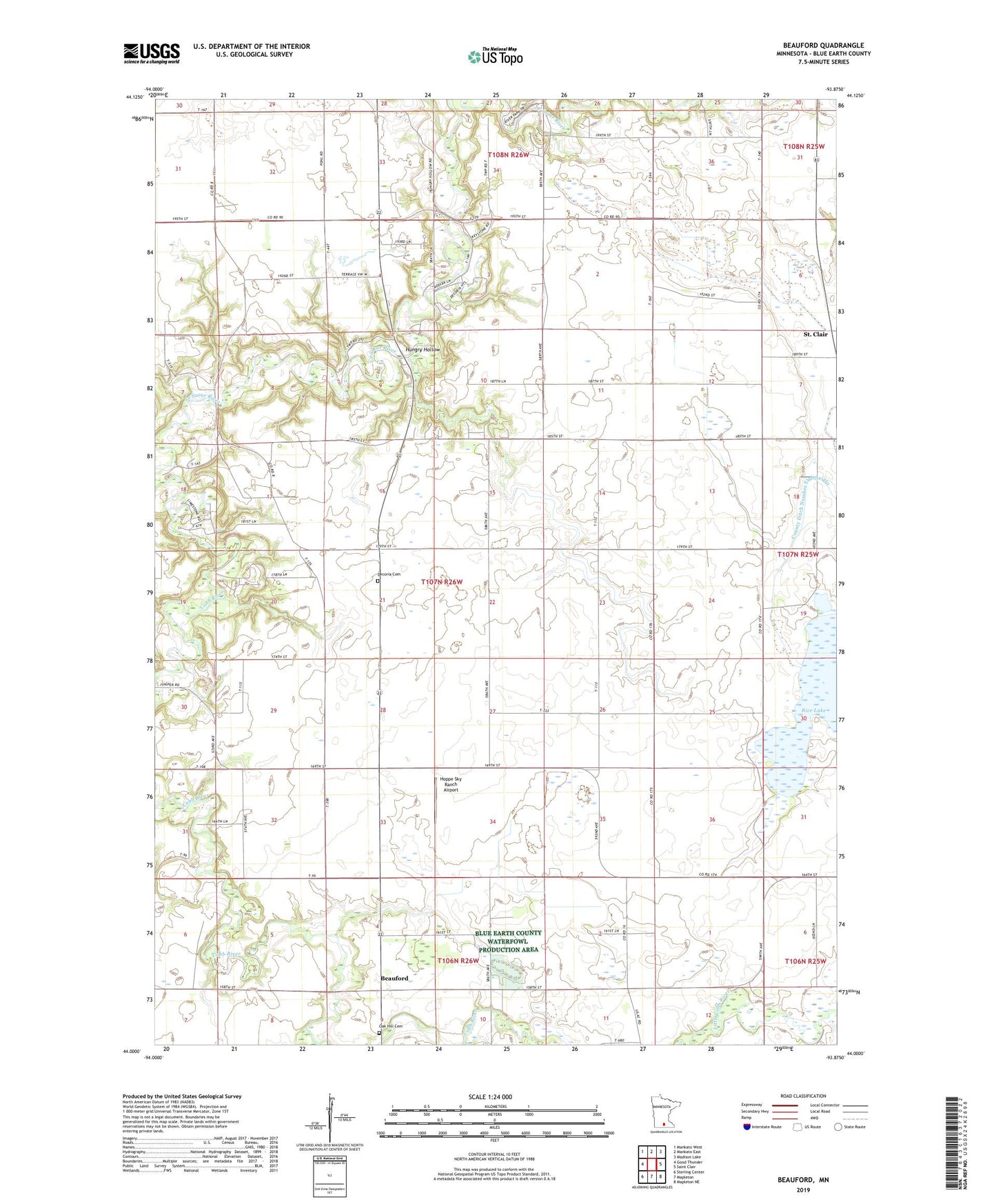
2022 topographic map quadrangle Beauford in the state of Minnesota. Scale: 1:24000. Based on the newly updated USGS 7.5' US Topo map series, this map is in the following counties: Blue Earth. The map contains contour data, water features, and other items you are used to seeing on USGS maps, but also has updated roads and other features. This is the next generation of topographic maps. Printed on high-quality waterproof paper with UV fade-resistant inks.
Quads adjacent to this one:
West: Good Thunder
Northwest: Mankato West
North: Mankato East
Northeast: Madison Lake
East: Saint Clair
Southeast: Mapleton NE
South: Mapleton
Southwest: Sterling Center
This map covers the same area as the classic USGS quad with code o44093a8.
Contains the following named places: Bearford United Methodist Church, Beauford, Beauford Post Office, County Ditch Number Eightyeight, County Ditch Number Twentyfive, Decoria Cemetery, Hoppe Sky Ranch Airport, Hungry Hollow, Mankato Farmstrip Airport, Oak Hill Cemetery, Redeemer Church, Rice Lake, Terrace View Golf Course, Township of Decoria, Victory Memorial Rest Area Historical Marker