MyTopo
Good Thunder Minnesota US Topo Map
Couldn't load pickup availability
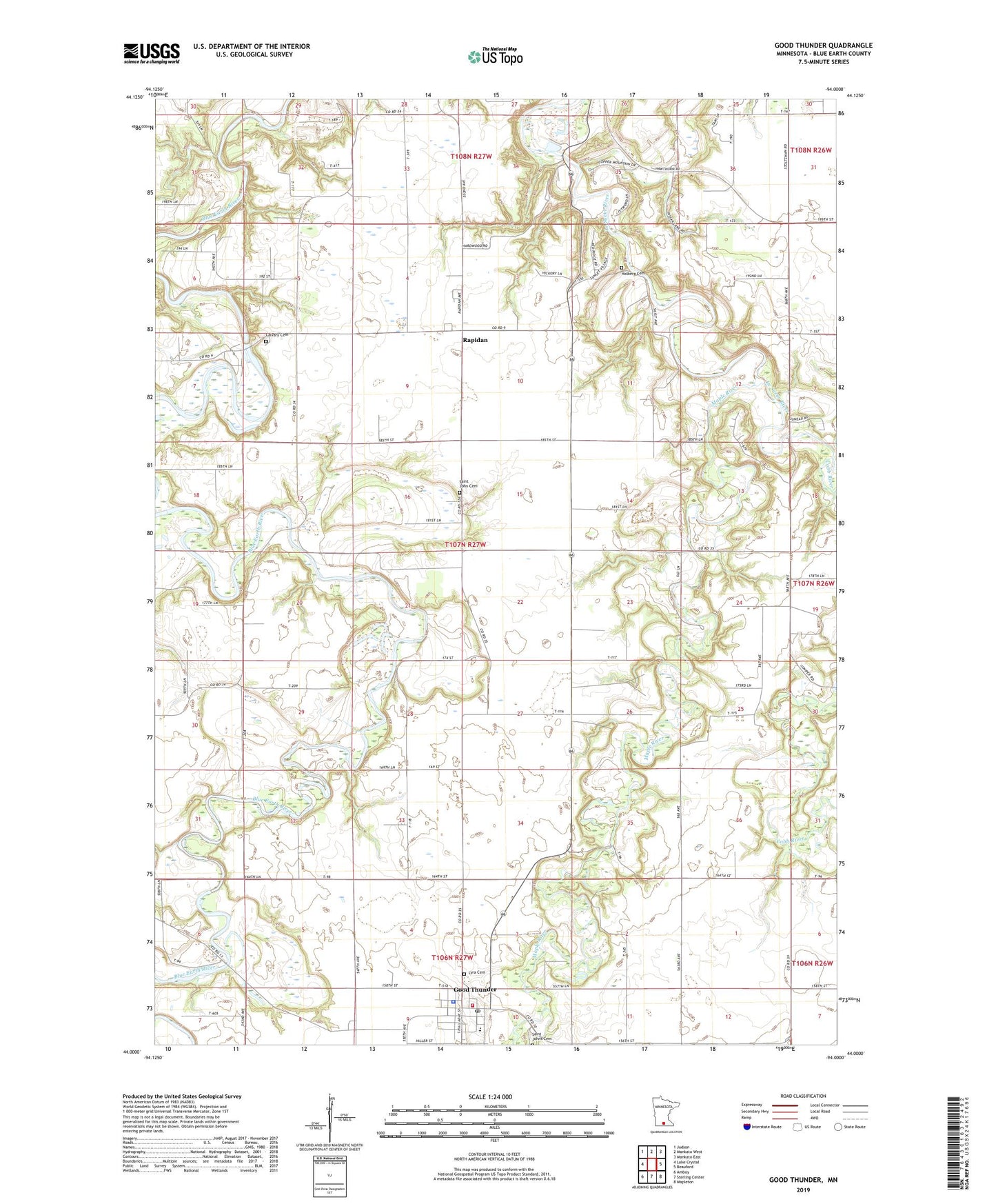
2022 topographic map quadrangle Good Thunder in the state of Minnesota. Scale: 1:24000. Based on the newly updated USGS 7.5' US Topo map series, this map is in the following counties: Blue Earth. The map contains contour data, water features, and other items you are used to seeing on USGS maps, but also has updated roads and other features. This is the next generation of topographic maps. Printed on high-quality waterproof paper with UV fade-resistant inks.
Quads adjacent to this one:
West: Lake Crystal
Northwest: Judson
North: Mankato West
Northeast: Mankato East
East: Beauford
Southeast: Mapleton
South: Sterling Center
Southwest: Amboy
This map covers the same area as the classic USGS quad with code o44094a1.
Contains the following named places: Blue Earth County, Calvary Cemetery, Calvary Lutheran Church, City of Good Thunder, Cobb River, Gage State Wildlife Management Area, Good Thunder, Good Thunder City Hall, Good Thunder Fire Department, Good Thunder Police Department, Good Thunder Post Office, Holberg Cemetery, Lyra Cemetery, Maple River, Maple River West Elementary School, Rapidan, Rapidan County Park, Rapidan Dam, Rapidan Lake, Rapidan Post Office, Saint John Cemetery, Saint John Lutheran Church, Saint John Lutheran School, Saint Joseph's Catholic Church, Township of Rapidan, ZIP Code: 56037