MyTopo
Beaulieu Minnesota US Topo Map
Couldn't load pickup availability
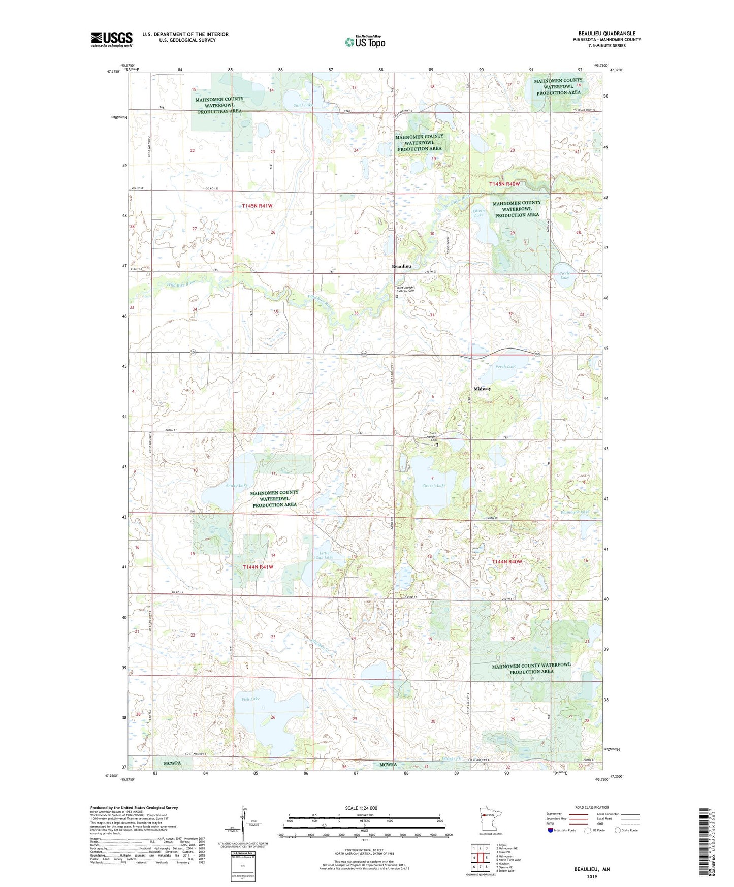
2019 topographic map quadrangle Beaulieu in the state of Minnesota. Scale: 1:24000. Based on the newly updated USGS 7.5' US Topo map series, this map is in the following counties: Mahnomen. The map contains contour data, water features, and other items you are used to seeing on USGS maps, but also has updated roads and other features. This is the next generation of topographic maps. Printed on high-quality waterproof paper with UV fade-resistant inks.
Quads adjacent to this one:
West: Mahnomen
Northwest: Bejou
North: Mahnomen NE
Northeast: Ebro NW
East: North Twin Lake
Southeast: Snider Lake
South: Ogema NE
Southwest: Waubun
Contains the following named places: Beaulieu, Beaulieu Census Designated Place, Beaulieu Post Office, Beaulife State Wildlife Management Area, Chief Lake, Church Lake, Circle Lake, Edwin Lake, Fish Lake, Little Oak Lake, Mahnomen County, Midway Census Designated Place, Perch Lake, Saint Joseph's Catholic Cemetery, Saint Joseph's Cemetery, Saint Josephs Church, Sandy Lake, Township of Chief, Township of Rosedale, Wambach Lake, ZIP Code: 56557