MyTopo
North Twin Lake Minnesota US Topo Map
Couldn't load pickup availability
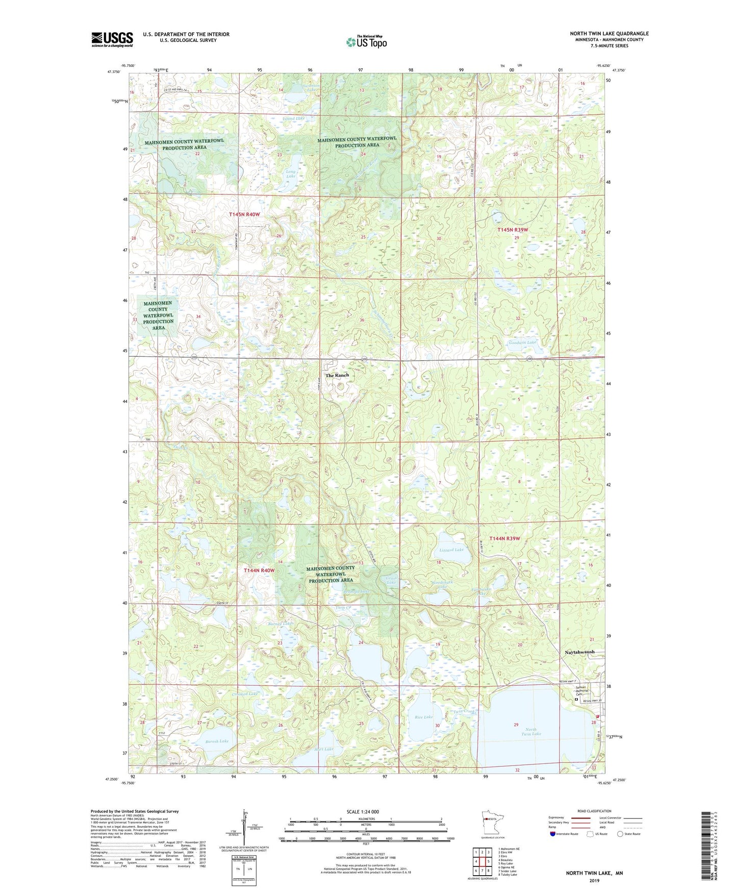
2022 topographic map quadrangle North Twin Lake in the state of Minnesota. Scale: 1:24000. Based on the newly updated USGS 7.5' US Topo map series, this map is in the following counties: Mahnomen. The map contains contour data, water features, and other items you are used to seeing on USGS maps, but also has updated roads and other features. This is the next generation of topographic maps. Printed on high-quality waterproof paper with UV fade-resistant inks.
Quads adjacent to this one:
West: Beaulieu
Northwest: Mahnomen NE
North: Ebro NW
Northeast: Ebro
East: Roy Lake
Southeast: Tulaby Lake
South: Snider Lake
Southwest: Ogema NE
This map covers the same area as the classic USGS quad with code o47095c6.
Contains the following named places: Badboy Creek, Barney Lakes, Buresh Lake, Crooked Lake, Daigle Lake, Fairbanks Lake, Gardner Lake, Goodwin Lake, Grass Lake, Hart Lake, Indian Cemetery, Island Lake, Little Rice Lake, Lizzard Lake, Long Lake, Naytahwaush, Naytahwaush Census Designated Place, Naytahwaush School, North Twin Lake, Peabody Lake, Rice Lake, Saint Anne Catholic Church, Samuel Memorial Cemetery, Samuel Memorial Lutheran Church, Sargent Lake, Schimmelhorn Creek, Swanson Lake, The Ranch Census Designated Place, Township of Beaulieu, Township of La Garde, Twin Creek, Twin Lakes Volunteer Fire Department, Woodchuck Lake