MyTopo
Fort Ripley Minnesota US Topo Map
Couldn't load pickup availability
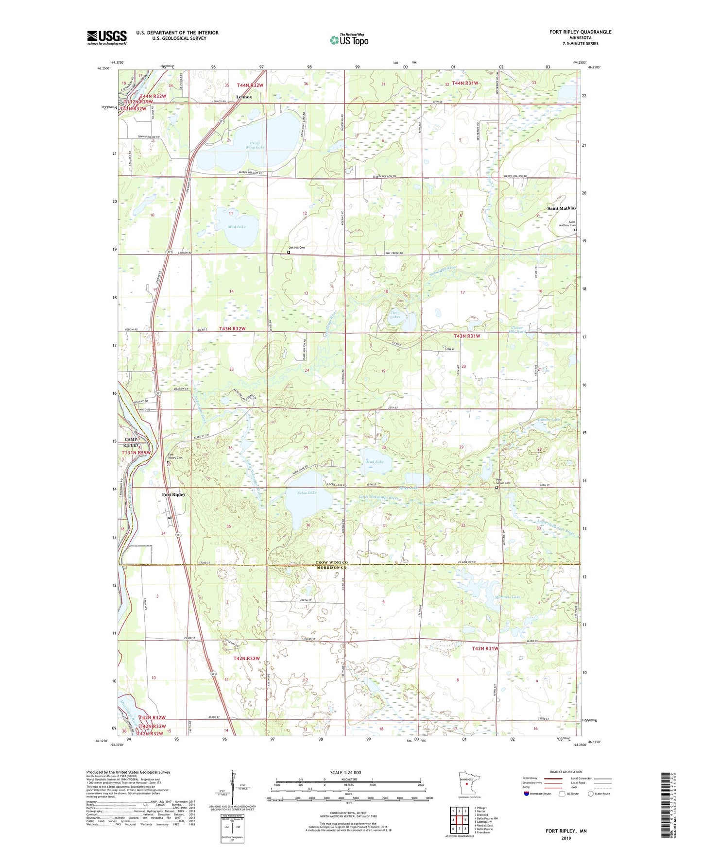
2022 topographic map quadrangle Fort Ripley in the state of Minnesota. Scale: 1:24000. Based on the newly updated USGS 7.5' US Topo map series, this map is in the following counties: Crow Wing, Morrison. The map contains contour data, water features, and other items you are used to seeing on USGS maps, but also has updated roads and other features. This is the next generation of topographic maps. Printed on high-quality waterproof paper with UV fade-resistant inks.
Quads adjacent to this one:
West: Belle Prairie NW
Northwest: Pillager
North: Baxter
Northeast: Brainerd
East: Lastrup NW
Southeast: Freedhem
South: Belle Prairie
Southwest: Randall East
This map covers the same area as the classic USGS quad with code o46094b3.
Contains the following named places: City of Fort Ripley, Clover Hill Pond, Crow Wing Lake, Don and Mayva's Campground, Eagles Landing Golf Club, Fort Ripley, Fort Ripley Cemetery, Fort Ripley Post Office, Gibson Lake, Hay Creek, Jinks Lake, KLIZ-FM (Brainerd), Lennox, Lenox Post Office, Little Nokasippi River, Michaels Lake, Moffat Post Office, Mud Lake, Nokasippi River, Nokasippi River Historical Monument, Oak Hill Cemetery, Pine Grove Cemetery, Saint Mathias, Saint Mathias Catholic Cemetery, Saint Mathias Church, Saint Mathias Post Office, School Number 13, School Number 16, School Number 32, School Number 8, Sebie Lake, Township of Fort Ripley, Township of Saint Mathias, Twin Lakes, ZIP Code: 56449