MyTopo
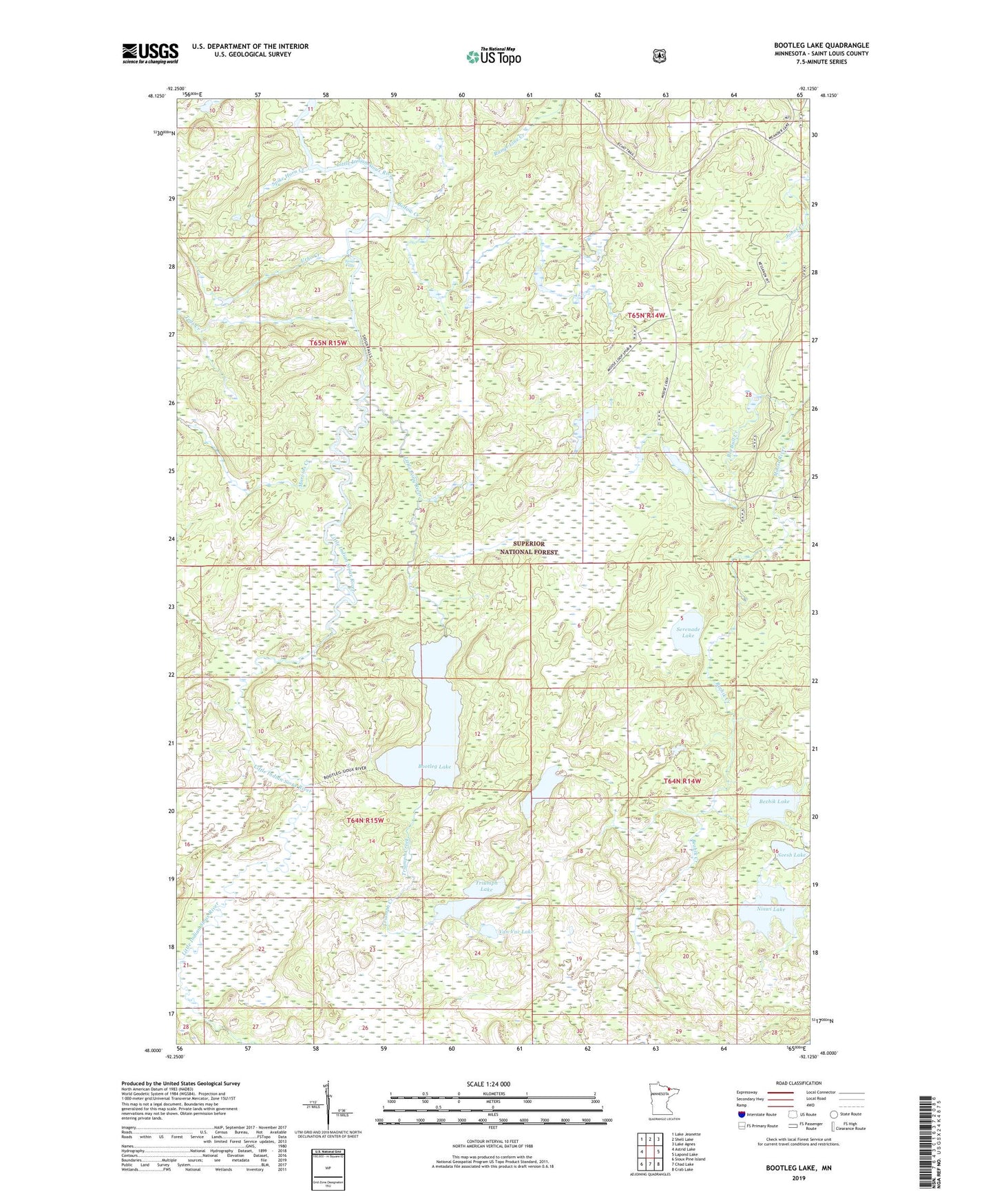
Bootleg Lake Minnesota US Topo Map
Couldn't load pickup availability
Also explore the Bootleg Lake Forest Service Topo of this same quad for updated USFS data
2022 topographic map quadrangle Bootleg Lake in the state of Minnesota. Scale: 1:24000. Based on the newly updated USGS 7.5' US Topo map series, this map is in the following counties: St. Louis. The map contains contour data, water features, and other items you are used to seeing on USGS maps, but also has updated roads and other features. This is the next generation of topographic maps. Printed on high-quality waterproof paper with UV fade-resistant inks.
Quads adjacent to this one:
West: Astrid Lake
Northwest: Lake Jeanette
North: Shell Lake
Northeast: Lake Agnes
East: Lapond Lake
Southeast: Crab Lake
South: Chad Lake
Southwest: Sioux Pine Island
This map covers the same area as the classic USGS quad with code o48092a2.
Contains the following named places: Bellow Creek, Bezhik Creek, Bezhik Lake, Big Bull Creek, Bootleg Lake, Canthook Lake, Echo Trail, Little Pony River, Marvins Creek, Neesh Lake, Nisswi Lake, Serenade Lake, Sioux Falls, Spike Horn Creek, Teds Creek, Triumph Creek, Triumph Lake, Unorganized Territory of Northeast Saint Louis, Urho Creek, Van Vac Lake