MyTopo
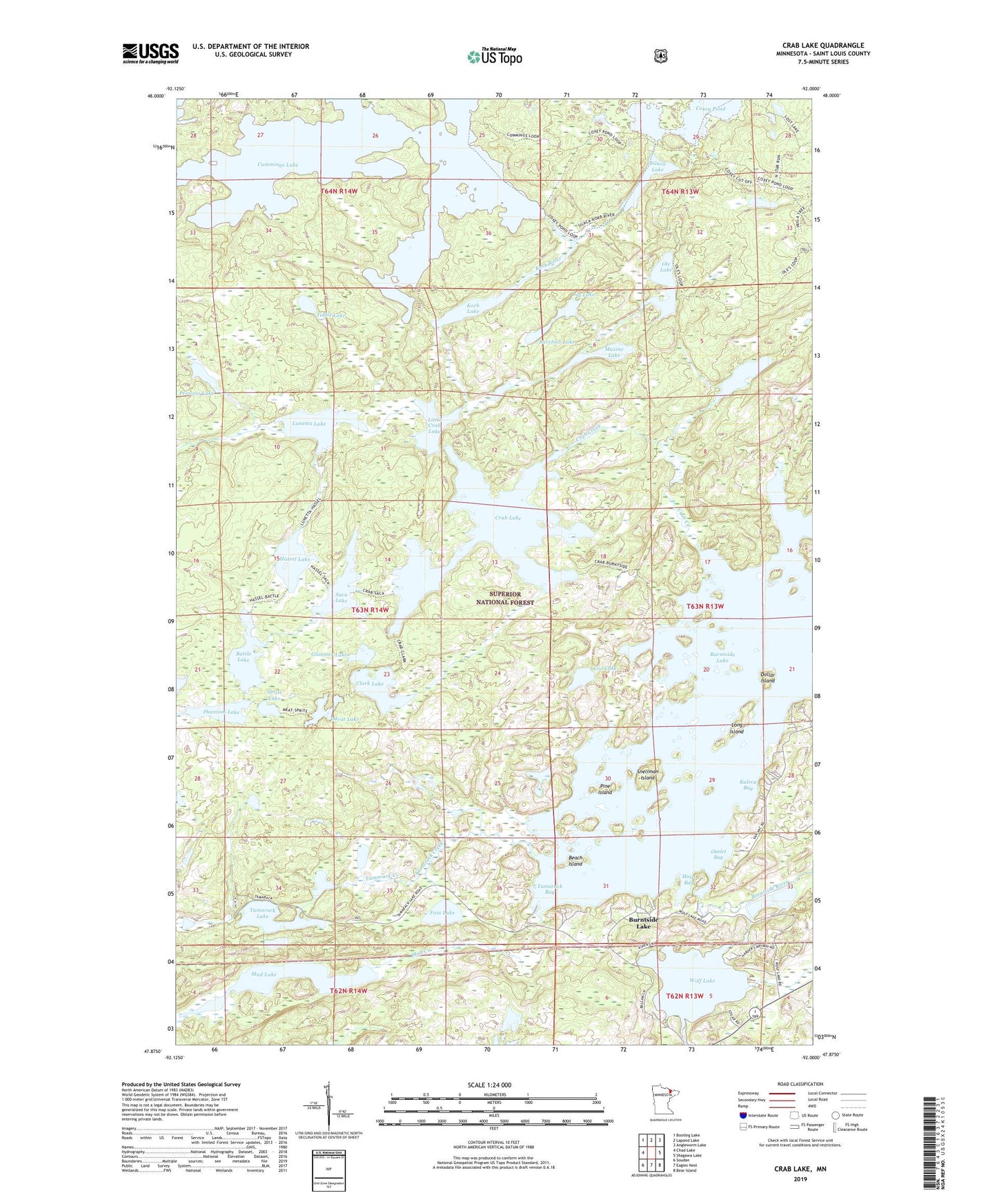
Crab Lake Minnesota US Topo Map
Couldn't load pickup availability
Also explore the Crab Lake Forest Service Topo of this same quad for updated USFS data
2022 topographic map quadrangle Crab Lake in the state of Minnesota. Scale: 1:24000. Based on the newly updated USGS 7.5' US Topo map series, this map is in the following counties: St. Louis. The map contains contour data, water features, and other items you are used to seeing on USGS maps, but also has updated roads and other features. This is the next generation of topographic maps. Printed on high-quality waterproof paper with UV fade-resistant inks.
Quads adjacent to this one:
West: Chad Lake
Northwest: Bootleg Lake
North: Lapond Lake
Northeast: Angleworm Lake
East: Shagawa Lake
Southeast: Bear Island
South: Eagles Nest
Southwest: Soudan
This map covers the same area as the classic USGS quad with code o47092h1.
Contains the following named places: Barefoot Lake, Battle Lake, Beach Island, Burnt Island, Burntside Lake, Burntside State Forest, Clark Lake, Coo Lake, Coxey Pond, Crab Creek, Crab Lake, Cummings Lake, Dollar Island, Foss Lake, Geraldine Lake, Glimmer Lake, Hassel Lake, Hoist Bay, Jig Lake, Kaleva Bay, Korb Lake, Korb River, Little Crab Lake, Long Island, Lunetta Lake, Maxine Lake, Meat Lake, Mud Lake, Nea Post Office, Ole Lake, Outlet Bay, Phantom Lake, Pine Island, Princess Lake, Saca Lake, School Section Bay, Silaca Lake, Snellman Island, Sprite Lake, Tamarack Bay, Tamarack Creek, Tamarack Lake, Tidbit Lake, Unorganized Territory of Crab Lake, Wolf Lake