MyTopo
Genoa Wisconsin US Topo Map
Couldn't load pickup availability
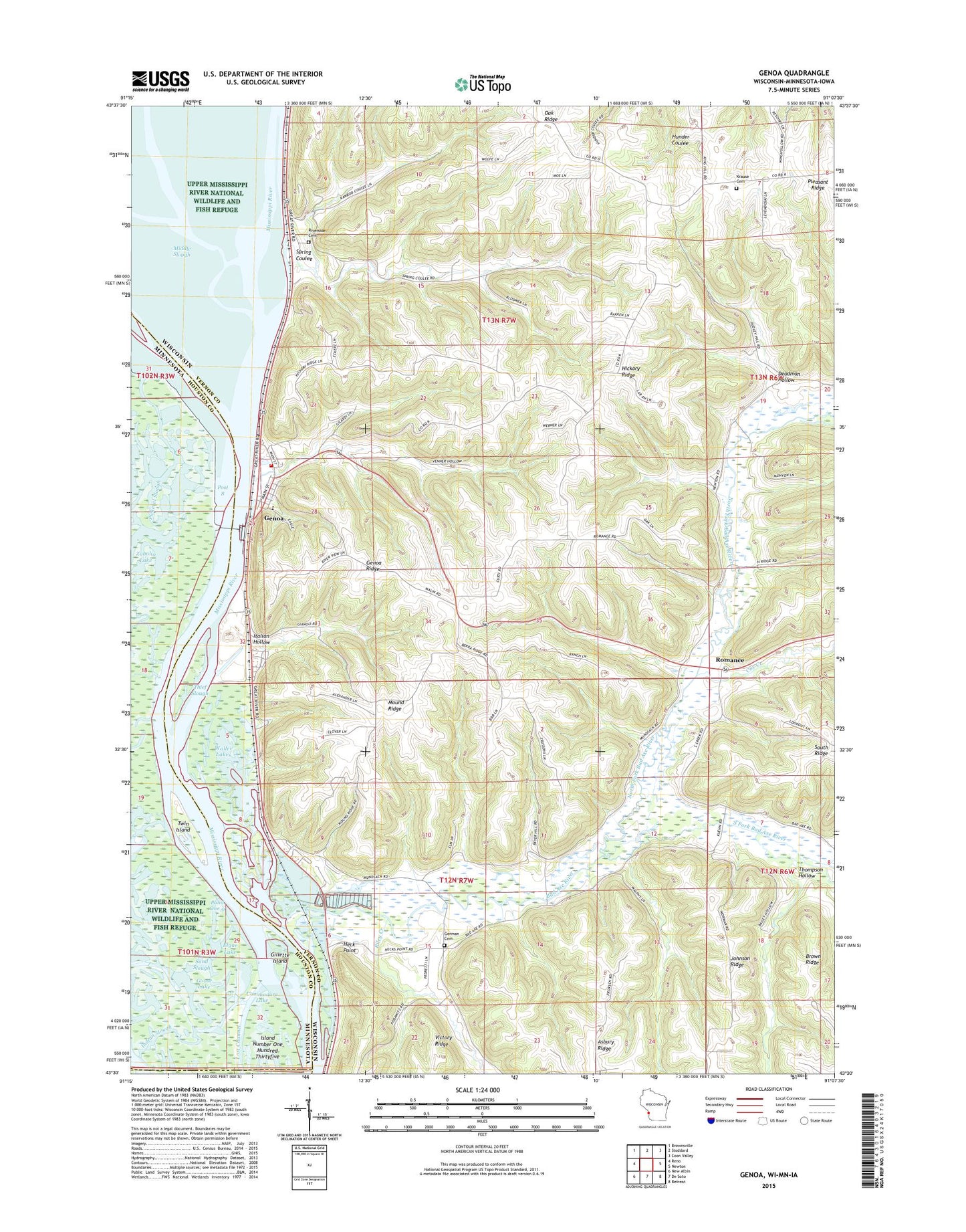
2022 topographic map quadrangle Genoa in the states of Wisconsin, Minnesota. Scale: 1:24000. Based on the newly updated USGS 7.5' US Topo map series, this map is in the following counties: Vernon, Houston, Allamakee. The map contains contour data, water features, and other items you are used to seeing on USGS maps, but also has updated roads and other features. This is the next generation of topographic maps. Printed on high-quality waterproof paper with UV fade-resistant inks.
Quads adjacent to this one:
West: Reno
Northwest: Brownsville
North: Stoddard
Northeast: Coon Valley
East: Newton
Southeast: Retreat
South: De Soto
Southwest: New Albin
This map covers the same area as the classic USGS quad with code o43091e2.
Contains the following named places: Bad Axe Landing, Bad Axe River, Bad Axe Valley School, Commodore Lake, Cox Creek, Deadman Hollow, Elgar Lake, Genoa, Genoa - Harmony Fire and Rescue, Genoa Fish Hatchery Pond 3 Dam, Genoa Fish Hatchery Pond One Dam, Genoa Generating Station, Genoa National Fish Hatchery, Genoa Post Office, Genoa Ridge, German Cemetery, Gillette Island, Goose Lake, Heck Point, Hickory Ridge, Hickory Ridge School, Indian Slough, Island Number One Hundred Thirtyfive, Italian Hollow, Johnson Ridge, Krause Cemetery, Lepke School, Lock and Dam 8, Lock and Dam Number 8, Lost Channel, Mound Ridge, Mound Ridge School, North Fork Bad Axe River, Pond One 0, Pond Three 0, Pool 8, Riley Creek, Riverside Cemetery, Riverside School, Romance, Romance Prairie State Natural Area, Romance School, Saint Charles Elementary School, Saint Johns Church, South Fork Bad Axe River, Spring Coulee, Thief Slough, Thompson Hollow, Town of Genoa, Twin Island, Victory Ridge, Village of Genoa, Waller Lakes, Zabolio Lake, ZIP Code: 54632