MyTopo
Brule Lake Minnesota US Topo Map
Couldn't load pickup availability
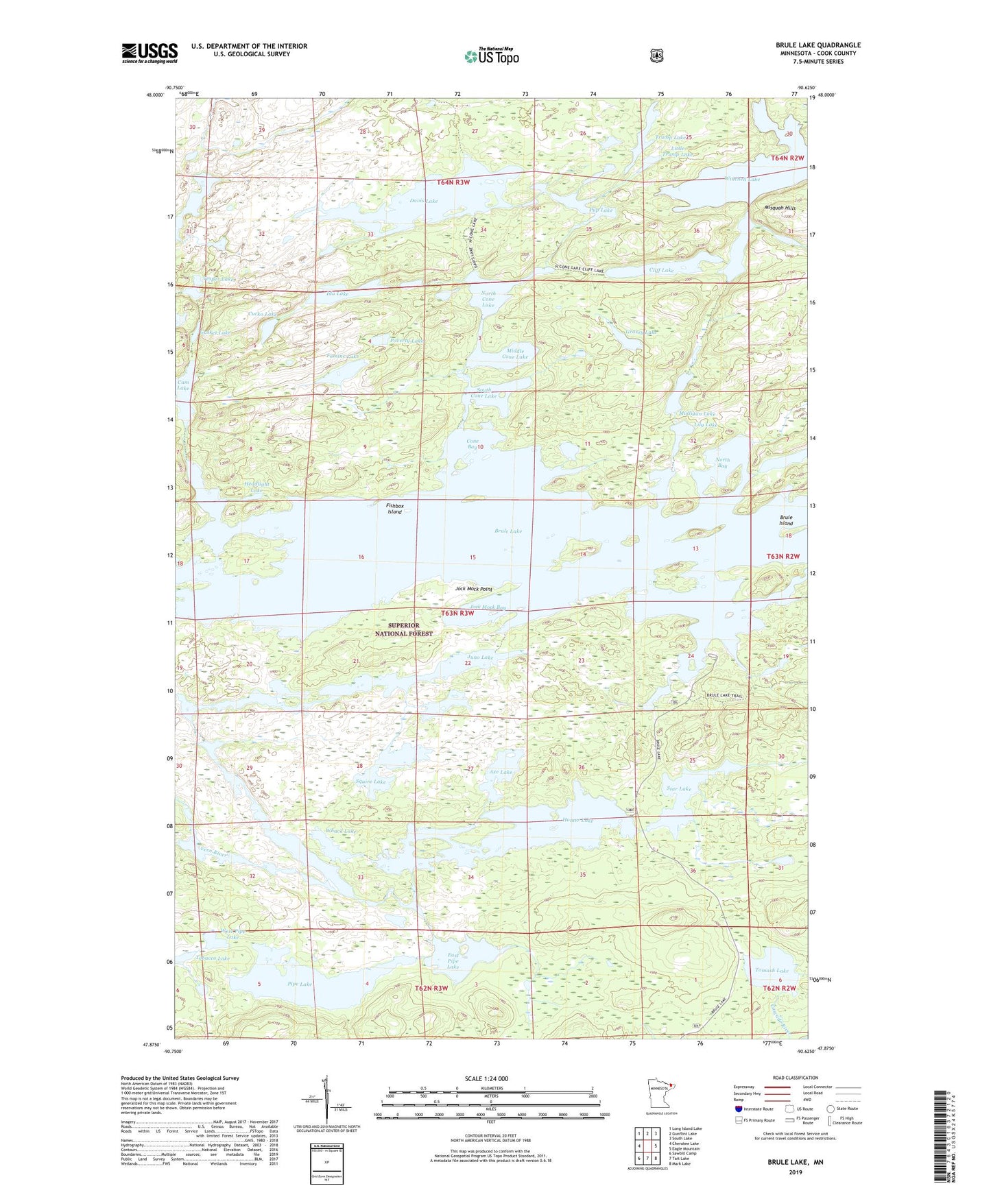
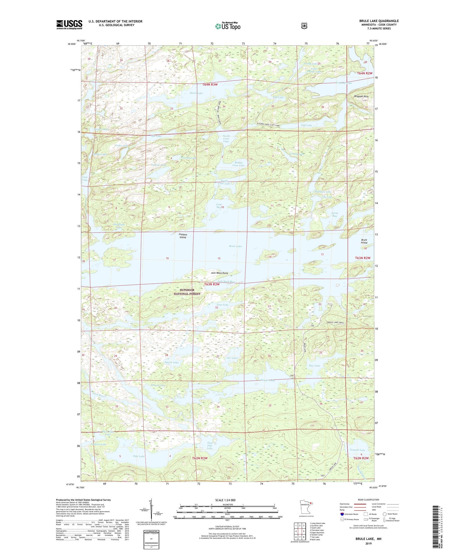
2019 topographic map quadrangle Brule Lake in the state of Minnesota. Scale: 1:24000. Based on the newly updated USGS 7.5' US Topo map series, this map is in the following counties: Cook. The map contains contour data, water features, and other items you are used to seeing on USGS maps, but also has updated roads and other features. This is the next generation of topographic maps. Printed on high-quality waterproof paper with UV fade-resistant inks.
Quads adjacent to this one:
West: Cherokee Lake
Northwest: Long Island Lake
North: Gunflint Lake
Northeast: South Lake
East: Eagle Mountain
Southeast: Mark Lake
South: Tait Lake
Southwest: Sawbill Camp
Contains the following named places: Axe Lake, Brule Island, Brule Lake, Brule Lake Lookout Tower, Cam Lake, Cash Lake, Cliff Lake, Cone Bay, Cucko Lake, Davis Lake, East Pipe Lake, Famine Lake, Fishbox Island, Gasket Lake, Grassy Lake, Headlight Lake, Homer Lake, Ida Lake, Jock Mock Bay, Jock Mock Point, Juno Lake, Lily Lake, Little Trump Lake, Middle Cone Lake, Mulligan Lake, North Bay, North Cone Lake, Pipe Lake, Poverty Lake, Pup Lake, South Cone Lake, Squire Lake, Star Lake, Tobacco Lake, Tomash Lake, Trump Lake, Unorganized Territory of West Cook, Vern Lake, Vesper Lake, Wanihigan Lake, West Pipe Lake, Whack Lake, Whip Lake