MyTopo
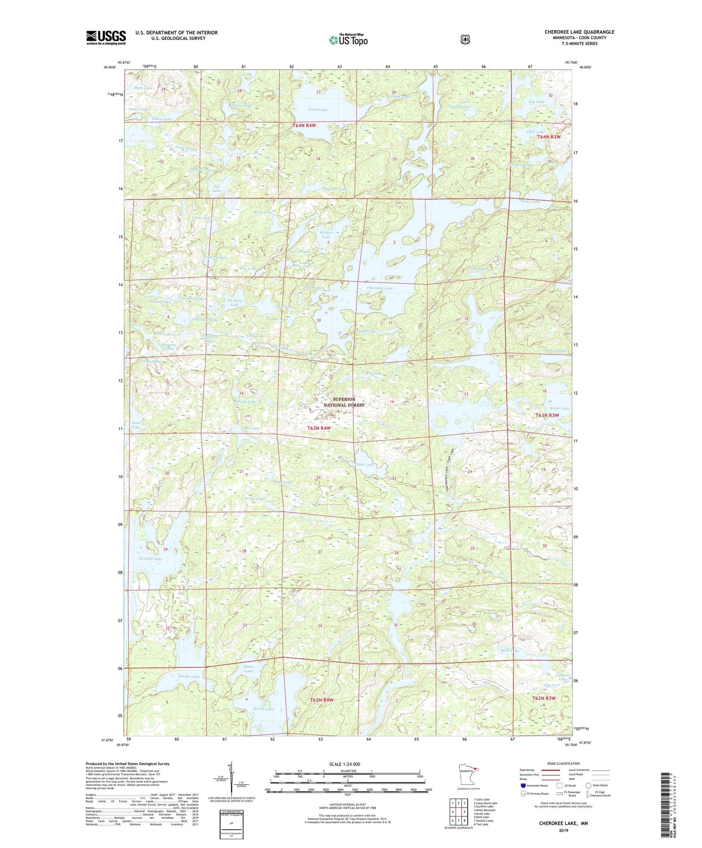
Cherokee Lake Minnesota US Topo Map
Couldn't load pickup availability
Also explore the Cherokee Lake Forest Service Topo of this same quad for updated USFS data
2022 topographic map quadrangle Cherokee Lake in the state of Minnesota. Scale: 1:24000. Based on the newly updated USGS 7.5' US Topo map series, this map is in the following counties: Cook. The map contains contour data, water features, and other items you are used to seeing on USGS maps, but also has updated roads and other features. This is the next generation of topographic maps. Printed on high-quality waterproof paper with UV fade-resistant inks.
Quads adjacent to this one:
West: Kelso Mountain
Northwest: Gillis Lake
North: Long Island Lake
Northeast: Gunflint Lake
East: Brule Lake
Southeast: Tait Lake
South: Sawbill Camp
Southwest: Beth Lake
This map covers the same area as the classic USGS quad with code o47090h7.
Contains the following named places: Ada Creek, Ada Lake, Arctic Lake, Aria Lake, Ash Lake, Bologna Lake, Burnt Lake, Cede Lake, Chase Lake, Cherokee Creek, Cherokee Lake, Choker Lake, Clam Lake, Cleft Lake, Cream Lake, Dalbec Lake, Fetters Lake, Flame Lake, Frost Lake, Fur Lake, Gordon Lake, Guard Lake, Gunstock Lake, Herb Lake, Hide Lake, Iris Lake, Jack Lake, Java Lake, Jay Lake, Myth Lake, Night Lake, No Sleep Lake, Noodle Lake, North Temperance Lake, Octopus Lake, Olio Lake, Pipe Creek, Ranger Lake, Siamese Lakes, Sitka Lake, Skoop Lake, Smoke Lake, Sneaker Lake, Sniff Lake, Snip Lake, Snub Lake, South Temperance Lake, Squish Lake, Stem Lake, Tent Lake, Tiny Lake, Town Lake, Triplet Lakes, Unload Lake, Uva Lake, Venus Lake, Vern River, Vigl Lake, Violation Lake, Weird Lake, Wench Lake, Wichita Lake, Wing Lake