MyTopo
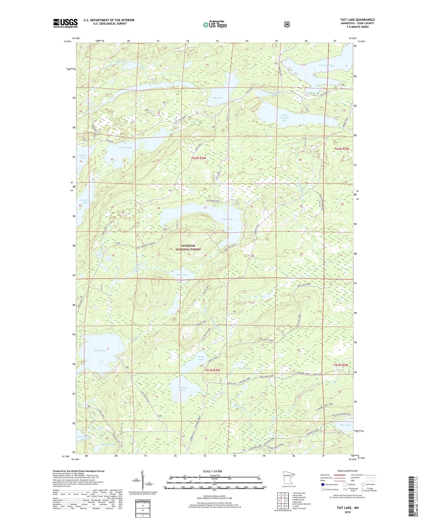
Tait Lake Minnesota US Topo Map
Couldn't load pickup availability
Also explore the Tait Lake Forest Service Topo of this same quad for updated USFS data
2022 topographic map quadrangle Tait Lake in the state of Minnesota. Scale: 1:24000. Based on the newly updated USGS 7.5' US Topo map series, this map is in the following counties: Cook. The map contains contour data, water features, and other items you are used to seeing on USGS maps, but also has updated roads and other features. This is the next generation of topographic maps. Printed on high-quality waterproof paper with UV fade-resistant inks.
Quads adjacent to this one:
West: Sawbill Camp
Northwest: Cherokee Lake
North: Brule Lake
Northeast: Eagle Mountain
East: Mark Lake
Southeast: Deer Yard Lake
South: Lutsen
Southwest: Honeymoon Mountain
This map covers the same area as the classic USGS quad with code o47090g6.
Contains the following named places: Bouder Lake, Cascade Lake, Hilly Lake, Holly Lake, Jock Mock Lake, Kinogami Lake, Lake Clara, Lake Gust, Lichen Lake, Little Cascade Lake, Mistletoe Lake, Roast Lake, Strobus Lake, Tait Lake, Township of Lutsen, Williams Lake, Wills Lake, ZIP Code: 55612