MyTopo
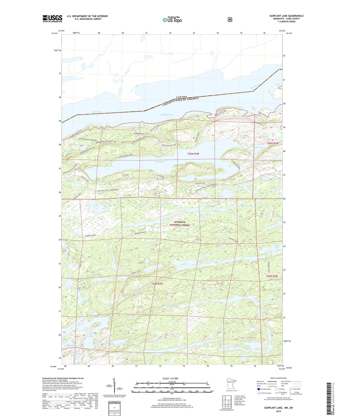
Gunflint Lake Minnesota US Topo Map
Couldn't load pickup availability
Also explore the Gunflint Lake Forest Service Topo of this same quad for updated USFS data
2022 topographic map quadrangle Gunflint Lake in the state of Minnesota. Scale: 1:24000. Based on the newly updated USGS 7.5' US Topo map series, this map is in the following counties: Cook. The map contains contour data, water features, and other items you are used to seeing on USGS maps, but also has updated roads and other features. This is the next generation of topographic maps. Printed on high-quality waterproof paper with UV fade-resistant inks.
Quads adjacent to this one:
West: Long Island Lake
Northwest: Conners Island
East: South Lake
Southeast: Eagle Mountain
South: Brule Lake
Southwest: Cherokee Lake
This map covers the same area as the classic USGS quad with code o48090a6.
Contains the following named places: Banadad Creek, Banadad Lake, Bedew Lake, Benning Lake, Cave Lake, Crab Lake, East Dawkins Lake, Ferret Lake, Finn Creek, Finn Lake, Fun Lake, George Lake, Gunflint Lake, Gunflint Seaplane Base, Kiskadinna Lake, Little Iron Lake, Lizard Lake, Lonely Lake, Loon Lake, Mash Lake, Muskeg Lake, Omega Lake, Phalanx Lake, Ross Lake, Sea Lake, Sebeka Lake, Trip Lake, Tucker Lake, Tucker River