MyTopo
Long Island Lake Minnesota US Topo Map
Couldn't load pickup availability
Also explore the Long Island Lake Forest Service Topo of this same quad for updated USFS data
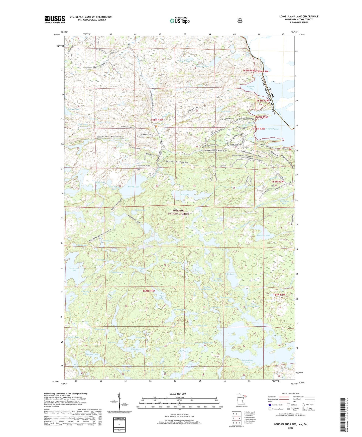
2022 topographic map quadrangle Long Island Lake in the state of Minnesota. Scale: 1:24000. Based on the newly updated USGS 7.5' US Topo map series, this map is in the following counties: Cook. The map contains contour data, water features, and other items you are used to seeing on USGS maps, but also has updated roads and other features. This is the next generation of topographic maps. Printed on high-quality waterproof paper with UV fade-resistant inks.
Quads adjacent to this one:
West: Gillis Lake
Northwest: Munker Island
North: Conners Island
East: Gunflint Lake
Southeast: Brule Lake
South: Cherokee Lake
Southwest: Kelso Mountain
This map covers the same area as the classic USGS quad with code o48090a7.
Contains the following named places: Ahgoday Lake, Auk Lake, Blue Snow Lake, Brant Lake, Burt Lake, Chub Lake, Contest Lake, Copper Lake, Cross Bay Lake, Cross River, Cross River Landing, Dawkins Creek, Dawkins Lake, Din Lake, Doe Lake, Dogleg Lake, Don Lake, Edith Lake, Ell Lake, Ernest Lake, Extortion Creek, Extortion Lake, Fawn Lake, Fool Lake, Fungus Lake, Gunflint Lookout Tower, Gunflint Trail Volunteer Fire Department Station 2, Hairy Lake, Ham Creek, Ham Lake, Howl Lake, Hubbub Lake, Jester Lake, Juniper Lake, Karl Lake, Kerfoot Lakes, Little Copper Lake, Little Rock Falls, Long Island Lake, Long Island River, Lower George Lake, Lucky Pay Lake, Magnetic Lake, Mass Lake, Mavis Lake, Mine Lake, Missing Link Lake, Moth Lake, Plug Lake, Pogo Lake, Ragged Lake, Rib Lake, Rib Lake Trail, Round Lake, Round Lake Parking, Sea Gull Forest Service Station, Snipe Lake, Sora Lake, Swollen Ankle Lake, Tame Lake, Thelma Lake, West Round Lake, Wish Lake, Yogi Lake