MyTopo
Brush Creek Minnesota US Topo Map
Couldn't load pickup availability
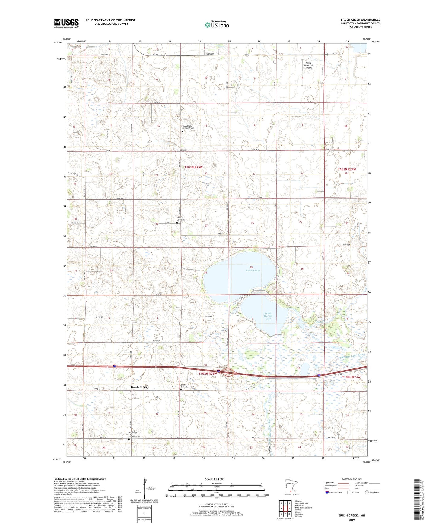
2022 topographic map quadrangle Brush Creek in the state of Minnesota. Scale: 1:24000. Based on the newly updated USGS 7.5' US Topo map series, this map is in the following counties: Faribault. The map contains contour data, water features, and other items you are used to seeing on USGS maps, but also has updated roads and other features. This is the next generation of topographic maps. Printed on high-quality waterproof paper with UV fade-resistant inks.
Quads adjacent to this one:
West: Oza Tanka Lakebed
Northwest: Easton
North: Minnesota Lake
Northeast: Matawan
East: Wells
Southeast: Kiester
South: Bricelyn
Southwest: Frost
This map covers the same area as the classic USGS quad with code o43093f7.
Contains the following named places: Brush Creek, Brush Creek Cemetery, Brush Creek Post Office, County Ditch Number Twenty, County Ditch Number Twentyfive, Foster Creek, North Blue Earth Church, North Blue Earth Lutheran Cemetery, South Walnut Lake, South Walnut Lake Dam, Tabor Church, Township of Brush Creek, Township of Walnut Lake, Walnut Lake, Walnut Lake Cemetery, Walnut Lake Methodist Cemetery, Walnut Lake State Wildlife Management Area, Wells Municipal Airport