MyTopo
Oza Tanka Lakebed Minnesota US Topo Map
Couldn't load pickup availability
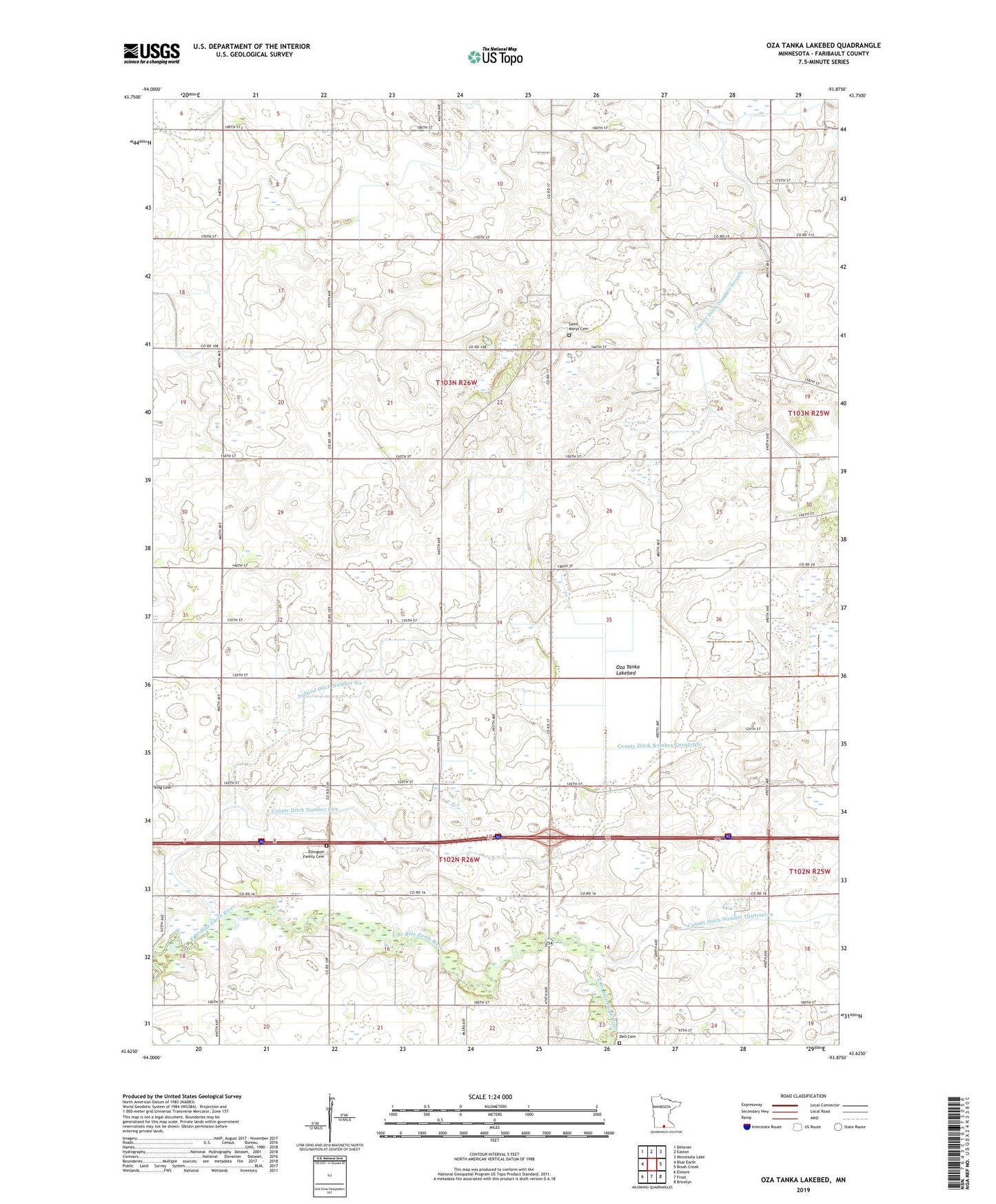
2022 topographic map quadrangle Oza Tanka Lakebed in the state of Minnesota. Scale: 1:24000. Based on the newly updated USGS 7.5' US Topo map series, this map is in the following counties: Faribault. The map contains contour data, water features, and other items you are used to seeing on USGS maps, but also has updated roads and other features. This is the next generation of topographic maps. Printed on high-quality waterproof paper with UV fade-resistant inks.
Quads adjacent to this one:
West: Blue Earth
Northwest: Delavan
North: Easton
Northeast: Minnesota Lake
East: Brush Creek
Southeast: Bricelyn
South: Frost
Southwest: Elmore
This map covers the same area as the classic USGS quad with code o43093f8.
Contains the following named places: Amundson Landing Strip, County Ditch Number Five, County Ditch Number Seventy, County Ditch Number Thirtyseven, Dell Cemetery, Ellingson Family Cemetery, Erdahl Landing Strip, Faribault County, Judicial Ditch Number Six, Martin Landing Strip, Oza Tanka Lakebed, Saint Marys Cemetery, Township of Barber, Township of Emerald