MyTopo
Minnesota Lake Minnesota US Topo Map
Couldn't load pickup availability
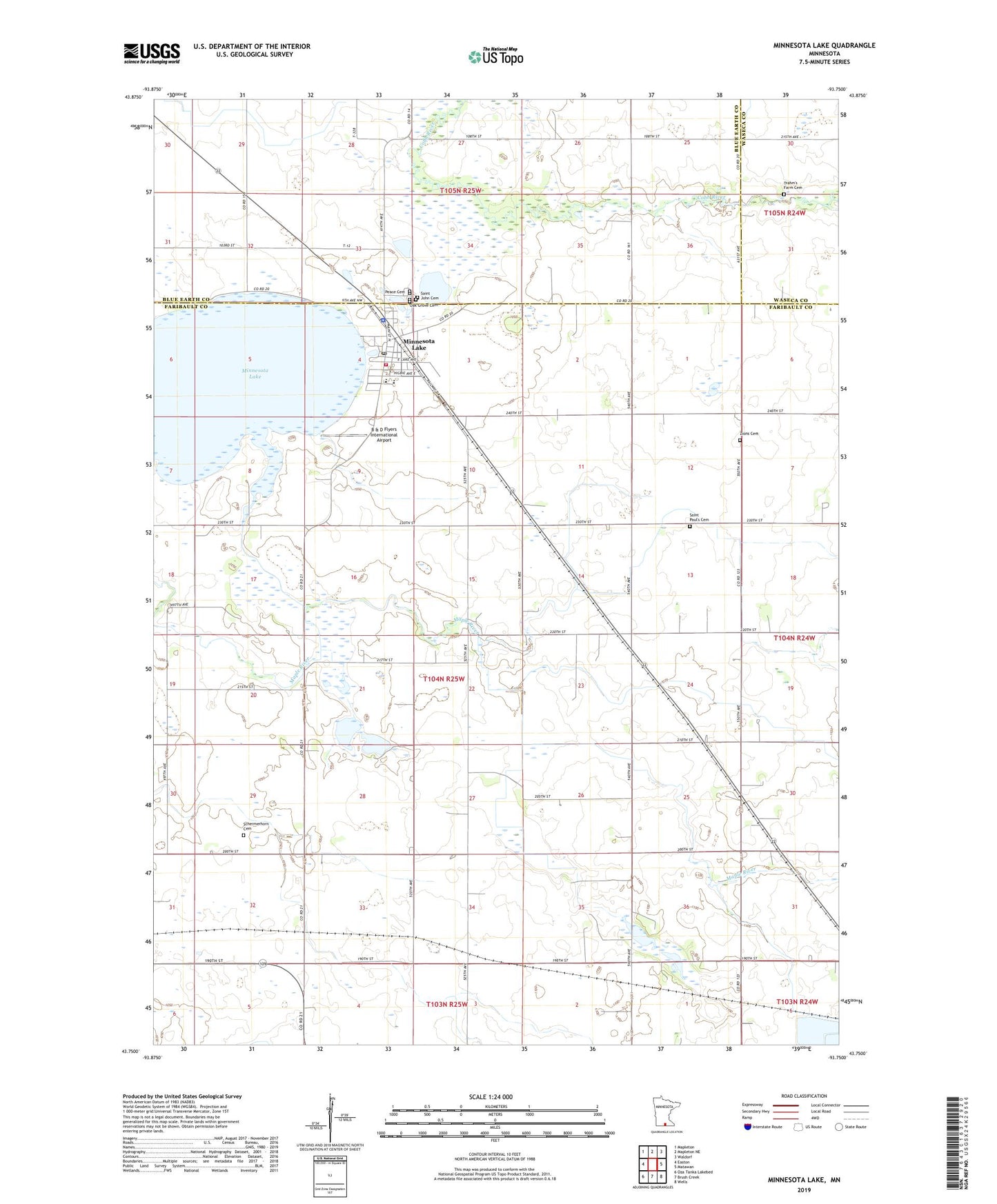
2022 topographic map quadrangle Minnesota Lake in the state of Minnesota. Scale: 1:24000. Based on the newly updated USGS 7.5' US Topo map series, this map is in the following counties: Faribault, Blue Earth, Waseca. The map contains contour data, water features, and other items you are used to seeing on USGS maps, but also has updated roads and other features. This is the next generation of topographic maps. Printed on high-quality waterproof paper with UV fade-resistant inks.
Quads adjacent to this one:
West: Easton
Northwest: Mapleton
North: Mapleton NE
Northeast: Waldorf
East: Matawan
Southeast: Wells
South: Brush Creek
Southwest: Oza Tanka Lakebed
This map covers the same area as the classic USGS quad with code o43093g7.
Contains the following named places: B & D Flyers International Airport, City of Minnesota Lake, County Ditch Number Eightyfive, County Ditch Number Seventyseven, Kremer House Library and Museum, Maple River East Middle School, Minnesota Lake, Minnesota Lake Ambulance Service, Minnesota Lake Fire Department, Minnesota Lake Police Department, Minnesota Lake Post Office, Oak Grove Cemetery, Peace Cemetery, Peace United Church of Christ, Saint John Baptist Catholic Church, Saint John Cemetery, Saint Paul's Cemetery, Saint Pauls Church, Schermerhorn Cemetery, Stokman State Wildlife Management Area, Township of Minnesota Lake, Trahm's Farm Cemetery, Zions Cemetery, ZIP Code: 56068