MyTopo
Campbell Minnesota US Topo Map
Couldn't load pickup availability
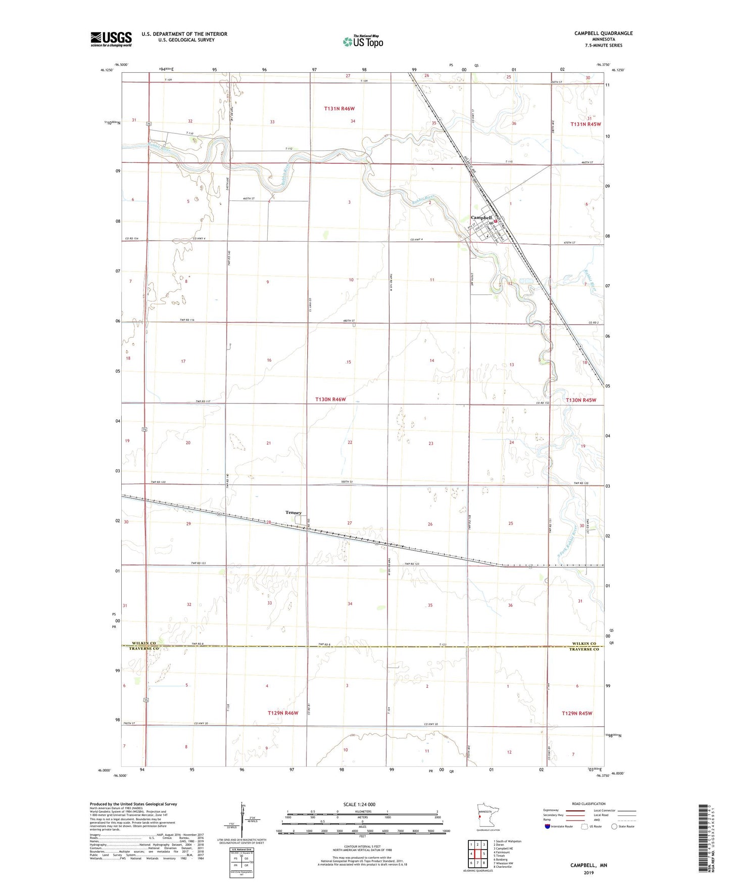
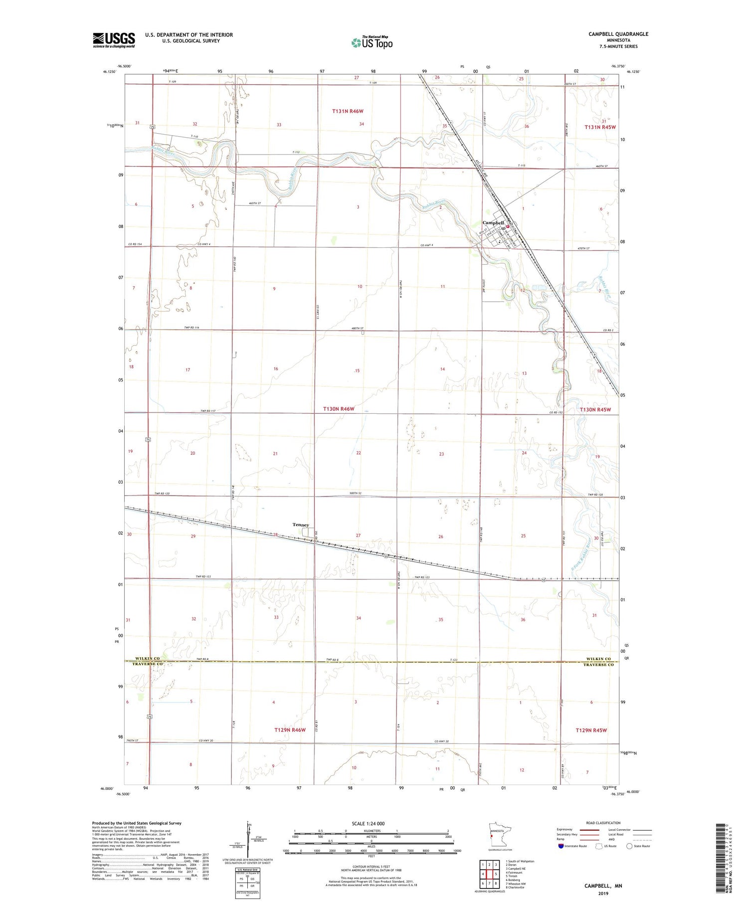
2019 topographic map quadrangle Campbell in the state of Minnesota. Scale: 1:24000. Based on the newly updated USGS 7.5' US Topo map series, this map is in the following counties: Wilkin, Traverse. The map contains contour data, water features, and other items you are used to seeing on USGS maps, but also has updated roads and other features. This is the next generation of topographic maps. Printed on high-quality waterproof paper with UV fade-resistant inks.
Quads adjacent to this one:
West: Fairmount
Northwest: South of Wahpeton
North: Doran
Northeast: Campbell NE
East: Tintah
Southeast: Charlesville
South: Wheaton NW
Southwest: Boisberg
Contains the following named places: Campbell, Campbell Fire Department, Campbell Post Office, Campbell Schools, City of Campbell, City of Tenney, Faith Community Church, Judicial Ditch Number Eleven, Judicial Ditch Number Eleven-Seven, Judicial Ditch Number Six, Saint Paul's Lutheran Church, School Number 44, South Fork Rabbit River, Tenney, Tenney Post Office, Township of Campbell, ZIP Code: 56583