MyTopo
Campbell NE Minnesota US Topo Map
Couldn't load pickup availability
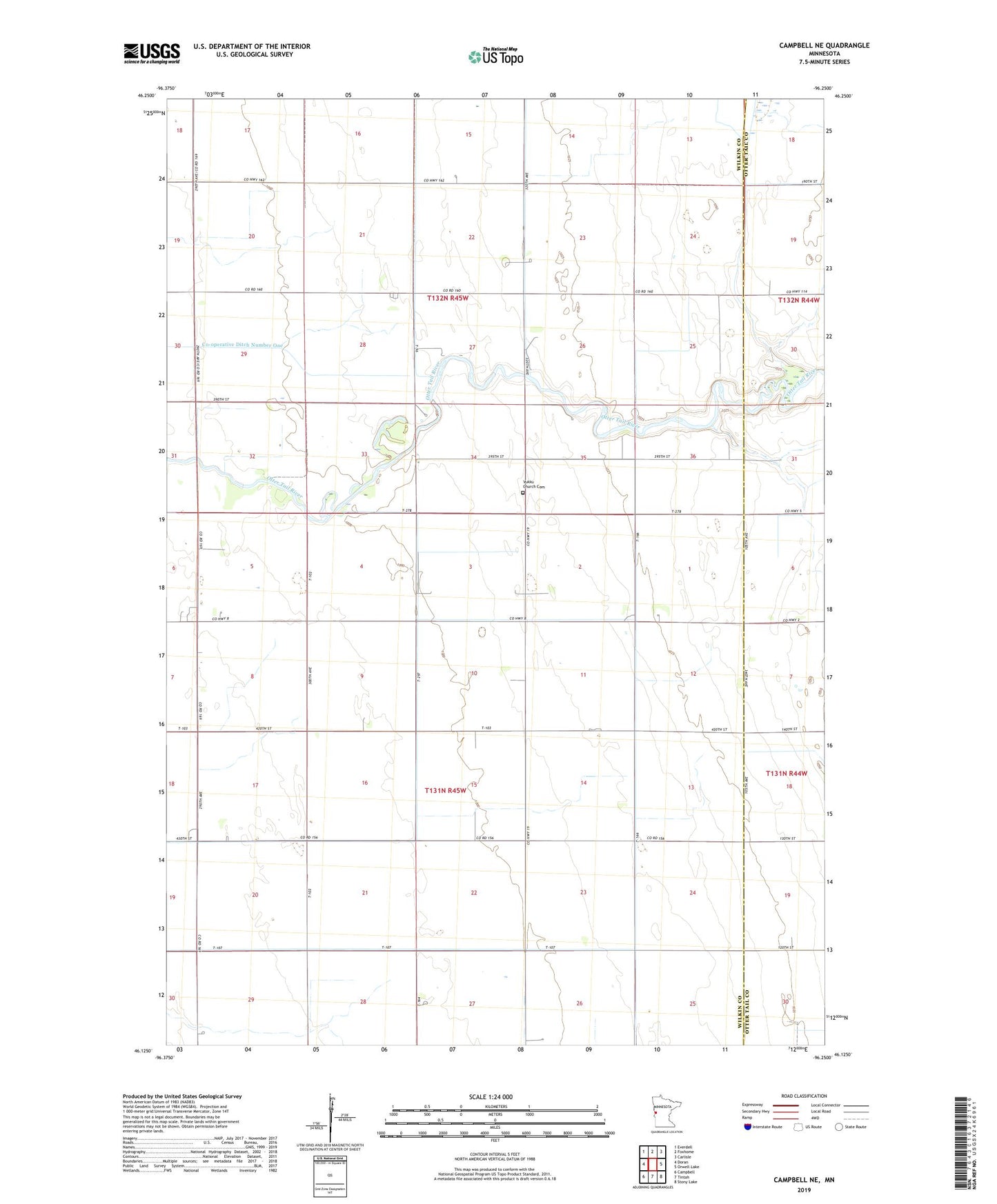
2022 topographic map quadrangle Campbell NE in the state of Minnesota. Scale: 1:24000. Based on the newly updated USGS 7.5' US Topo map series, this map is in the following counties: Wilkin, Otter Tail. The map contains contour data, water features, and other items you are used to seeing on USGS maps, but also has updated roads and other features. This is the next generation of topographic maps. Printed on high-quality waterproof paper with UV fade-resistant inks.
Quads adjacent to this one:
West: Doran
Northwest: Everdell
North: Foxhome
Northeast: Carlisle
East: Orwell Lake
Southeast: Stony Lake
South: Tintah
Southwest: Campbell
This map covers the same area as the classic USGS quad with code o46096b3.
Contains the following named places: Co-operative Ditch Number One, County Ditch Number Ten, School Number 16, School Number 32, School Number 54, School Number 62, Township of Bradford, Township of Foxhome, Vukka Lutheran Church, Vukku Church, Vukku Church Cemetery