MyTopo
Tintah Minnesota US Topo Map
Couldn't load pickup availability
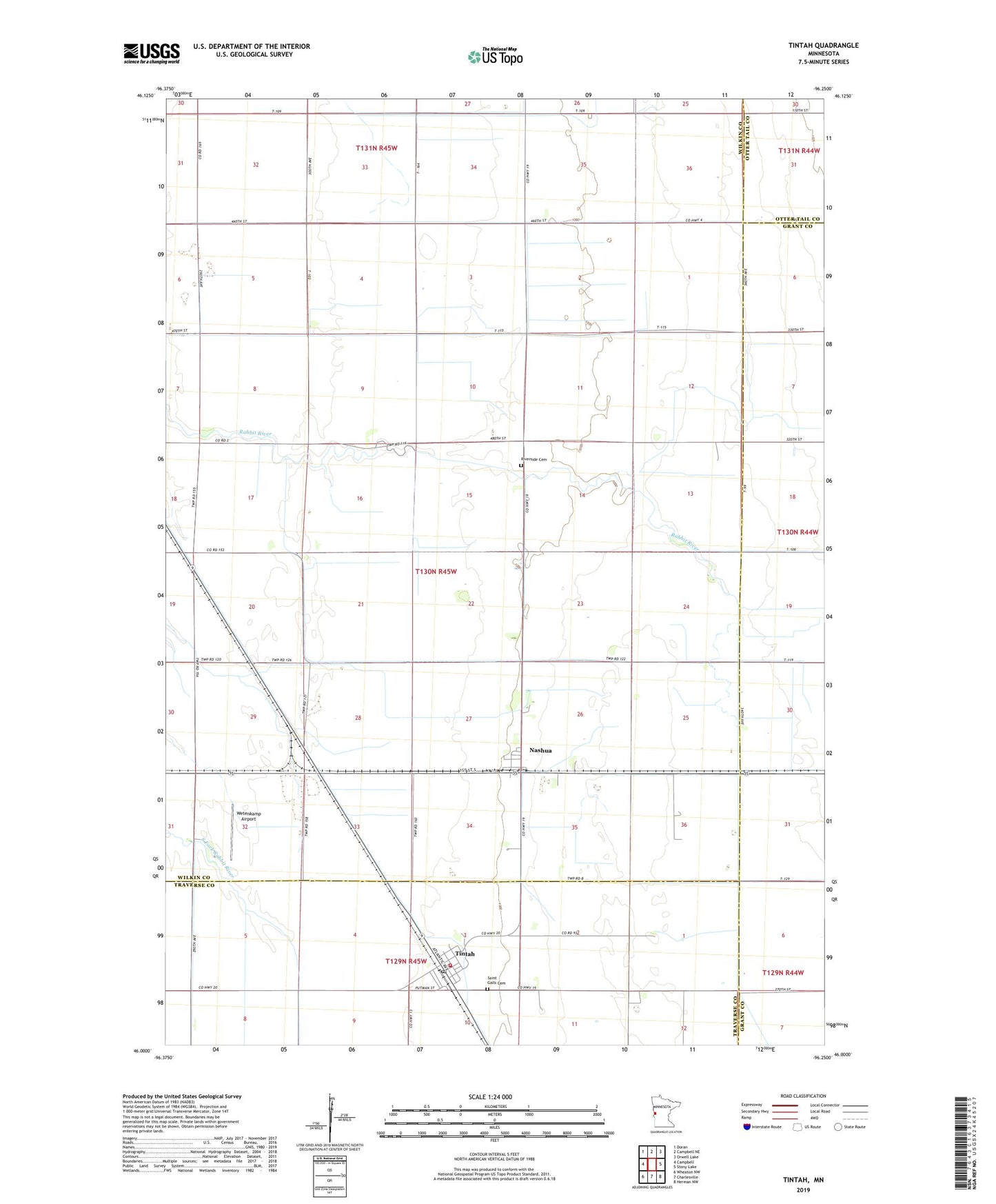
2022 topographic map quadrangle Tintah in the state of Minnesota. Scale: 1:24000. Based on the newly updated USGS 7.5' US Topo map series, this map is in the following counties: Wilkin, Traverse, Grant, Otter Tail. The map contains contour data, water features, and other items you are used to seeing on USGS maps, but also has updated roads and other features. This is the next generation of topographic maps. Printed on high-quality waterproof paper with UV fade-resistant inks.
Quads adjacent to this one:
West: Campbell
Northwest: Doran
North: Campbell NE
Northeast: Orwell Lake
East: Stony Lake
Southeast: Herman NW
South: Charlesville
Southwest: Wheaton NW
This map covers the same area as the classic USGS quad with code o46096a3.
Contains the following named places: City of Nashua, City of Tintah, County Ditch Number Eighteen, County Ditch Number Nine, County Ditch Number Twenty, First Congregational Church, Judicial Ditch Number Seven, Judicial Ditch Number Three, Nashua, Nashua Post Office, Riverside Cemetery, Saint Gall's Catholic Church, Saint Galls Cemetery, School Number 10, School Number 7, Tintah, Tintah Fire Department, Tintah Post Office, Township of Champion, Wetenkamp Airport, ZIP Code: 56565