MyTopo
Canton Minnesota US Topo Map
Couldn't load pickup availability
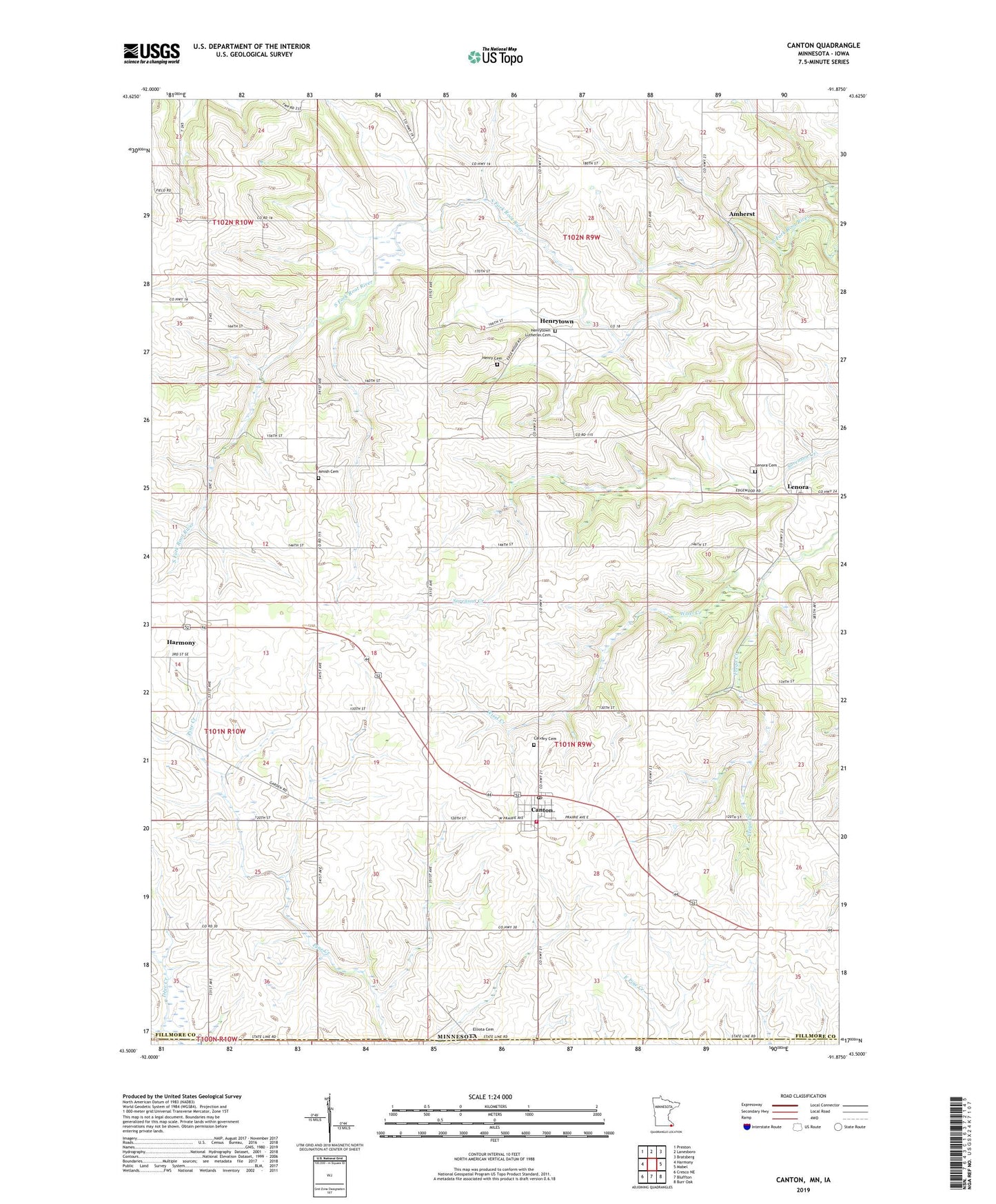
2022 topographic map quadrangle Canton in the state of Minnesota. Scale: 1:24000. Based on the newly updated USGS 7.5' US Topo map series, this map is in the following counties: Fillmore, Winneshiek. The map contains contour data, water features, and other items you are used to seeing on USGS maps, but also has updated roads and other features. This is the next generation of topographic maps. Printed on high-quality waterproof paper with UV fade-resistant inks.
Quads adjacent to this one:
West: Harmony
Northwest: Preston
North: Lanesboro
Northeast: Bratsberg
East: Mabel
Southeast: Burr Oak
South: Bluffton
Southwest: Cresco NE
This map covers the same area as the classic USGS quad with code o43091e8.
Contains the following named places: Amherst, Amherst Post Office, Amish Cemetery, Assumption Catholic Church, Calvary Cemetery, Canton, Canton Fire Department, Canton Plaza School, Canton Post Office, Canton Scotland Church, City of Canton, Elliota Cemetery, Frego Creek, Henry Cemetery, Henrytown, Henrytown Lutheran Cemetery, Henrytown Lutheran Church, Henrytown Post Office, Lenora, Lenora Cemetery, Lenora Post Office, Scotland Church, Township of Canton, ZIP Code: 55922