MyTopo
Lanesboro Minnesota US Topo Map
Couldn't load pickup availability
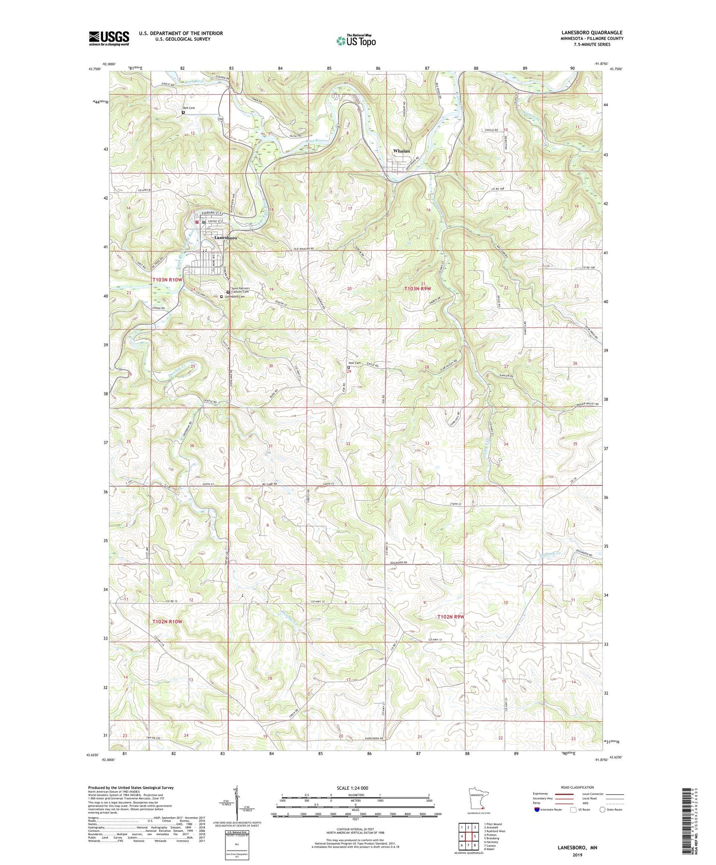
2022 topographic map quadrangle Lanesboro in the state of Minnesota. Scale: 1:24000. Based on the newly updated USGS 7.5' US Topo map series, this map is in the following counties: Fillmore. The map contains contour data, water features, and other items you are used to seeing on USGS maps, but also has updated roads and other features. This is the next generation of topographic maps. Printed on high-quality waterproof paper with UV fade-resistant inks.
Quads adjacent to this one:
West: Preston
Northwest: Pilot Mound
North: Arendahl
Northeast: Rushford West
East: Bratsberg
Southeast: Mabel
South: Canton
Southwest: Harmony
This map covers the same area as the classic USGS quad with code o43091f8.
Contains the following named places: Bell Cemetery, Bethlehem Lutheran Church, City of Lanesboro, City of Whalan, Diamond Creek, Duschee Creek, Eagle Cliff Campground, Elstad Church, Gribben Creek, H Ruen Dam, Highway 250 Campground, Holt Cemetery, Horihan-Hazel Group Dam, Howard Ruen Detention Group Dam, Inspiration Point Wayside Park, Lanesboro, Lanesboro Ambulance Service, Lanesboro Cemetery, Lanesboro Dam, Lanesboro Fire Department, Lanesboro Golf Club, Lanesboro Historical Museum, Lanesboro Library, Lanesboro Police Department, Lanesboro Post Office, Lanesboro Secondary School, Lanesboro United Methodist Church, Lanesboro Visitors Center, Mill Pond, Minnesota's Norwegian Americans Historical Marker, Riverview Campground, Saint Patrick's Catholic Cemetery, Saint Patrick's Church, Sorenson Group Dam, South Branch Root River, Sylvan Park, Sylvan Park Campground, Township of Amherst, Township of Holt, Whalan, Whalan Post Office, Whalen Lutheran Church, ZIP Code: 55949