MyTopo
Chad Lake Minnesota US Topo Map
Couldn't load pickup availability
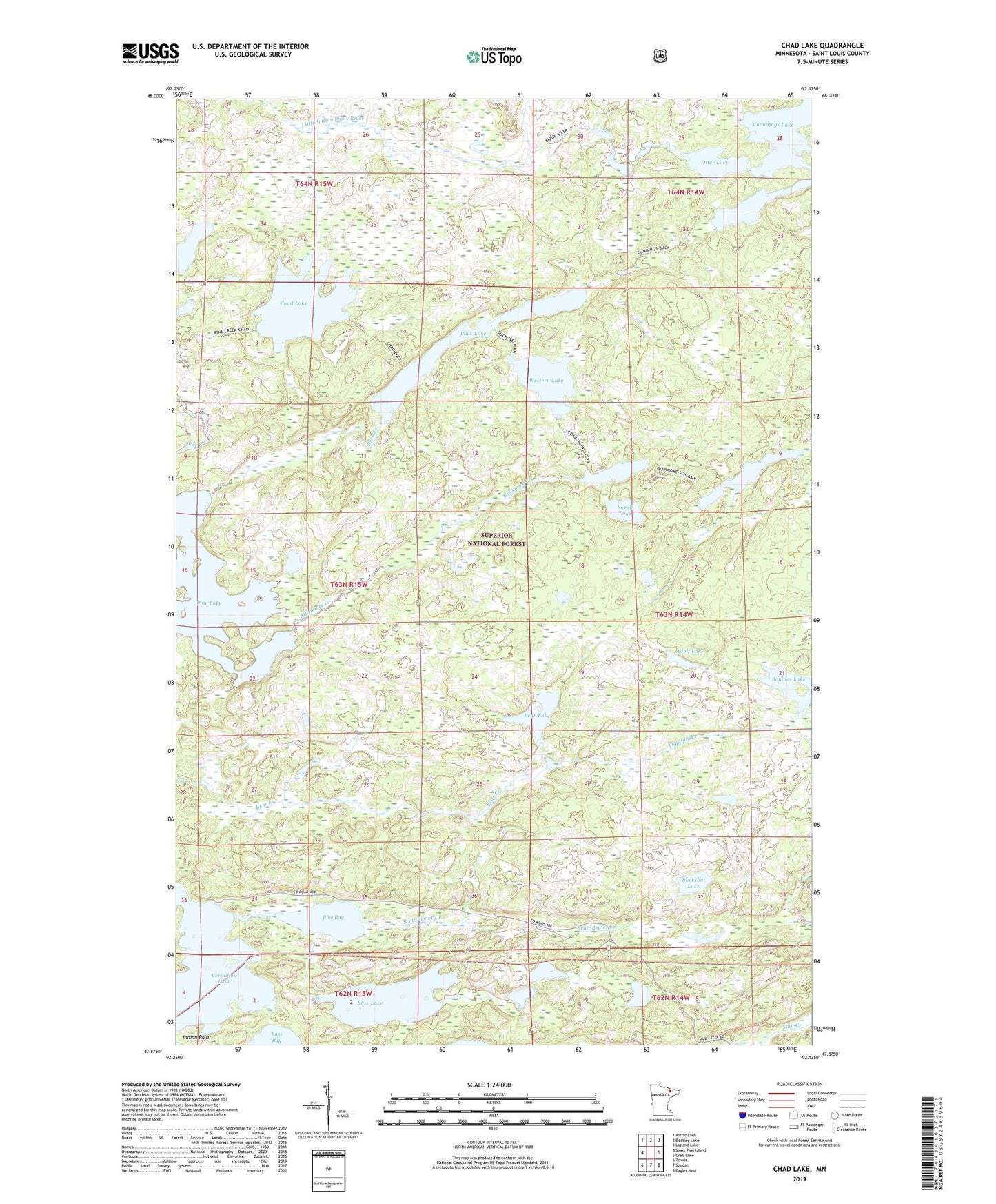
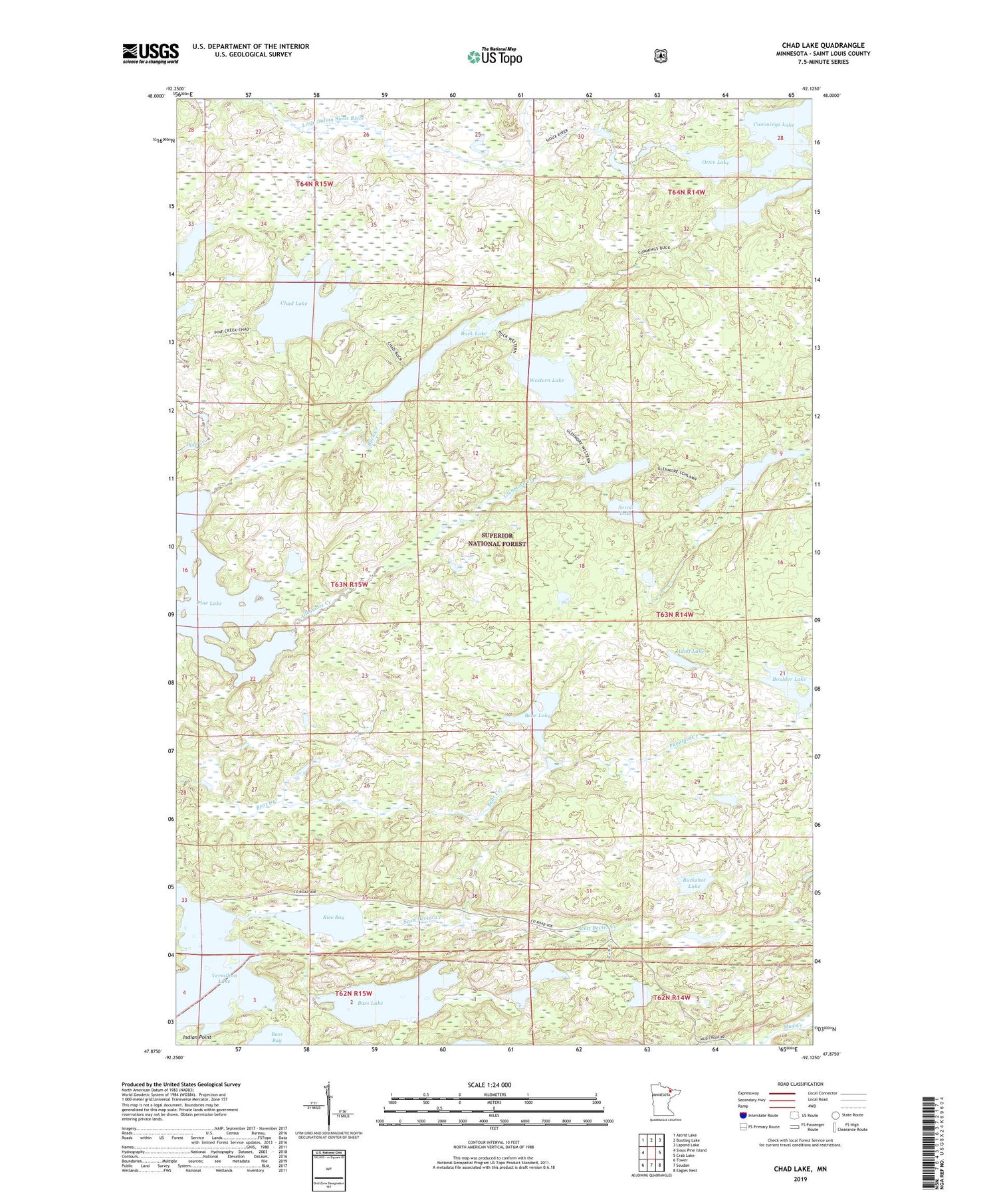
2019 topographic map quadrangle Chad Lake in the state of Minnesota. Scale: 1:24000. Based on the newly updated USGS 7.5' US Topo map series, this map is in the following counties: St. Louis. The map contains contour data, water features, and other items you are used to seeing on USGS maps, but also has updated roads and other features. This is the next generation of topographic maps. Printed on high-quality waterproof paper with UV fade-resistant inks.
Quads adjacent to this one:
West: Sioux Pine Island
Northwest: Astrid Lake
North: Bootleg Lake
Northeast: Lapond Lake
East: Crab Lake
Southeast: Eagles Nest
South: Soudan
Southwest: Tower
Contains the following named places: Adolf Lake, Bass Bay, Bass Lake, Bear Lake, Boulder Lake, Buck Creek, Buck Lake, Buckshot Lake, Chad Lake, Dugout Lake, Glenmore Creek, Glenmore Lake, Indian Point, Otter Lake, Phantom Creek, Pine Lake, Rice Bay, Schlamn Lake, Scott Bevier Creek, Soroll Lake, Western Lake