MyTopo
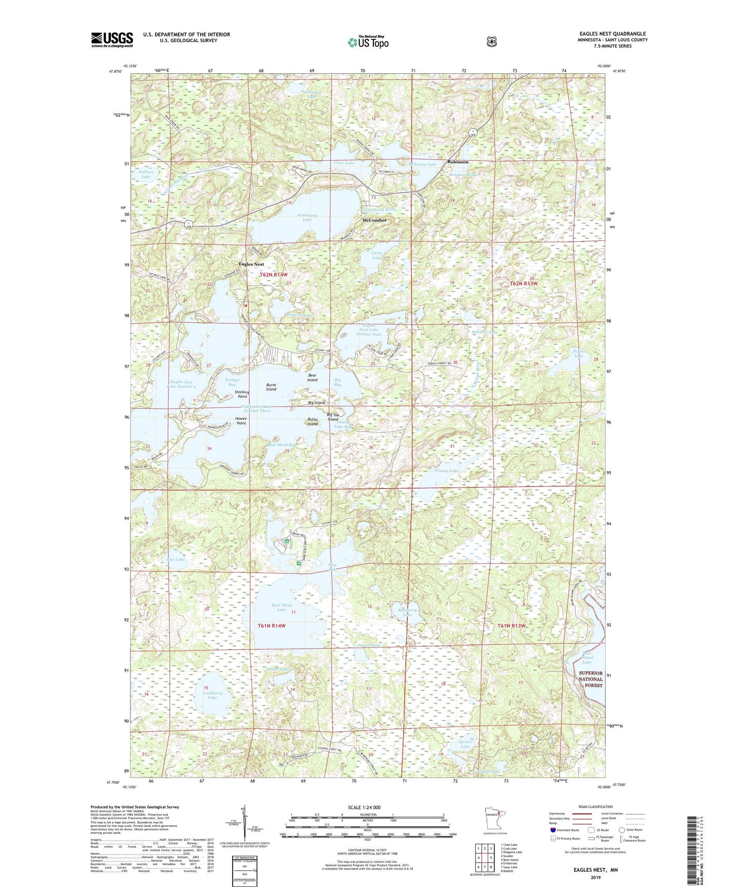
Eagles Nest Minnesota US Topo Map
Couldn't load pickup availability
Also explore the Eagles Nest Forest Service Topo of this same quad for updated USFS data
2022 topographic map quadrangle Eagles Nest in the state of Minnesota. Scale: 1:24000. Based on the newly updated USGS 7.5' US Topo map series, this map is in the following counties: St. Louis. The map contains contour data, water features, and other items you are used to seeing on USGS maps, but also has updated roads and other features. This is the next generation of topographic maps. Printed on high-quality waterproof paper with UV fade-resistant inks.
Quads adjacent to this one:
West: Soudan
Northwest: Chad Lake
North: Crab Lake
Northeast: Shagawa Lake
East: Bear Island
Southeast: Babbitt
South: Isaac Lake
Southwest: Embarrass
This map covers the same area as the classic USGS quad with code o47092g1.
Contains the following named places: Armstrong Lake, Bear Head Bay, Bear Head Lake, Bear Head Lake State Park, Bear Island, Big Bay, Big Island, Big Toe Island, Blueberry Lake, Burnt Island, Camp Lake, Clear Lake, Cranberry Lake, Deadman Lake, Eagles Nest, Eagles Nest Lake Number 2, Eagles Nest Lake Number Four, Eagles Nest Lake Number One, Eagles Nest Lake Number Three, Eagles Nest Volunteer Fire Department, East Bay, Gafvert Lake, Grassy Lake, Grassy Lake Bay, Holter Lake, Horseshoe Lake, Howes Point, McComber, McComber Post Office, McComber Station, Meadow Lake, Nickolson Lake, Pickerel Lake, Portage Bay, Purvis Lake, Purvis Ober State Natural Area, Robinson, Robinson Lake, Ruths Island, Spruce Lake, Square Lake, Star Lake, Stocking Point, Toikka Lake, Township of Eagles Nest, Unorganized Territory of Bear Head Lake