MyTopo
Elmwood Island Minnesota US Topo Map
Couldn't load pickup availability
Also explore the Elmwood Island Forest Service Topo of this same quad for updated USFS data
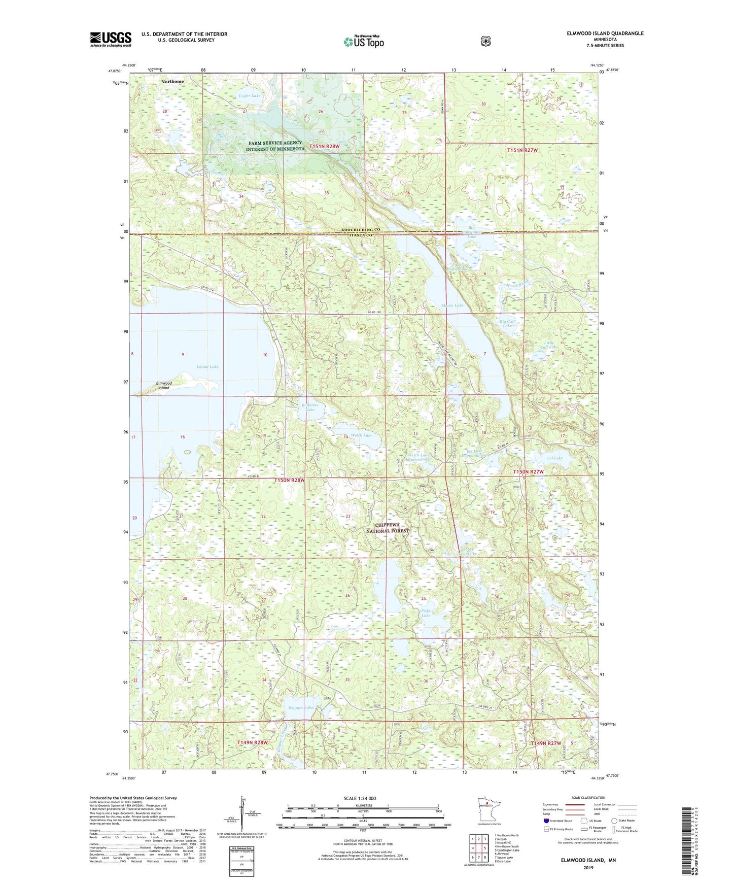
2022 topographic map quadrangle Elmwood Island in the state of Minnesota. Scale: 1:24000. Based on the newly updated USGS 7.5' US Topo map series, this map is in the following counties: Itasca, Koochiching. The map contains contour data, water features, and other items you are used to seeing on USGS maps, but also has updated roads and other features. This is the next generation of topographic maps. Printed on high-quality waterproof paper with UV fade-resistant inks.
Quads adjacent to this one:
West: Northome South
Northwest: Northome North
North: Mizpah
Northeast: Mizpah NE
East: Coddington Lake
Southeast: Dora Lake
South: Squaw Lake
Southwest: Alvwood
This map covers the same area as the classic USGS quad with code o47094g2.
Contains the following named places: Big Calf Lake, Big Constance Lake, Clover Leaf Lake, Cunningham Post Office, Eel Lake, Eel Lake Impoundment, Elmwood Island, Elmwood Island Trail System, Farm Service Agency Interest of Minnesota, Fiske Lake, Hendickson Lake, Island Lake, Little Calf Lake, Little Constance Lake, Little Moose Lake, Moose Lake, Teufer Lake, Township of Ardenhurst, Wagner Lake, Wagner Lake Lookout Tower, Welch Lake, Welch Lake Dam, Welch Lake Impoundment, Williams Lake, ZIP Code: 56661