MyTopo
Cold Spring Minnesota US Topo Map
Couldn't load pickup availability
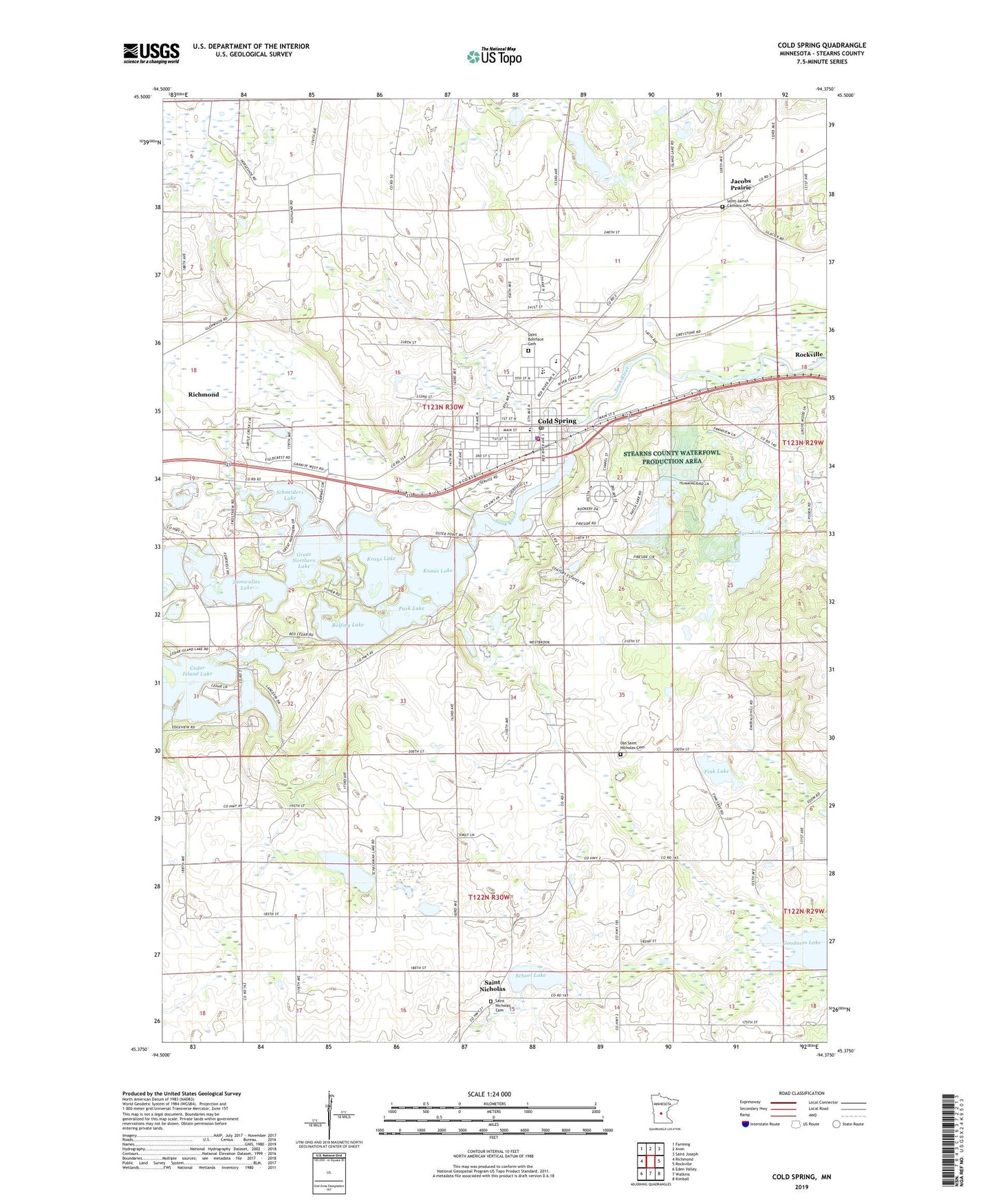
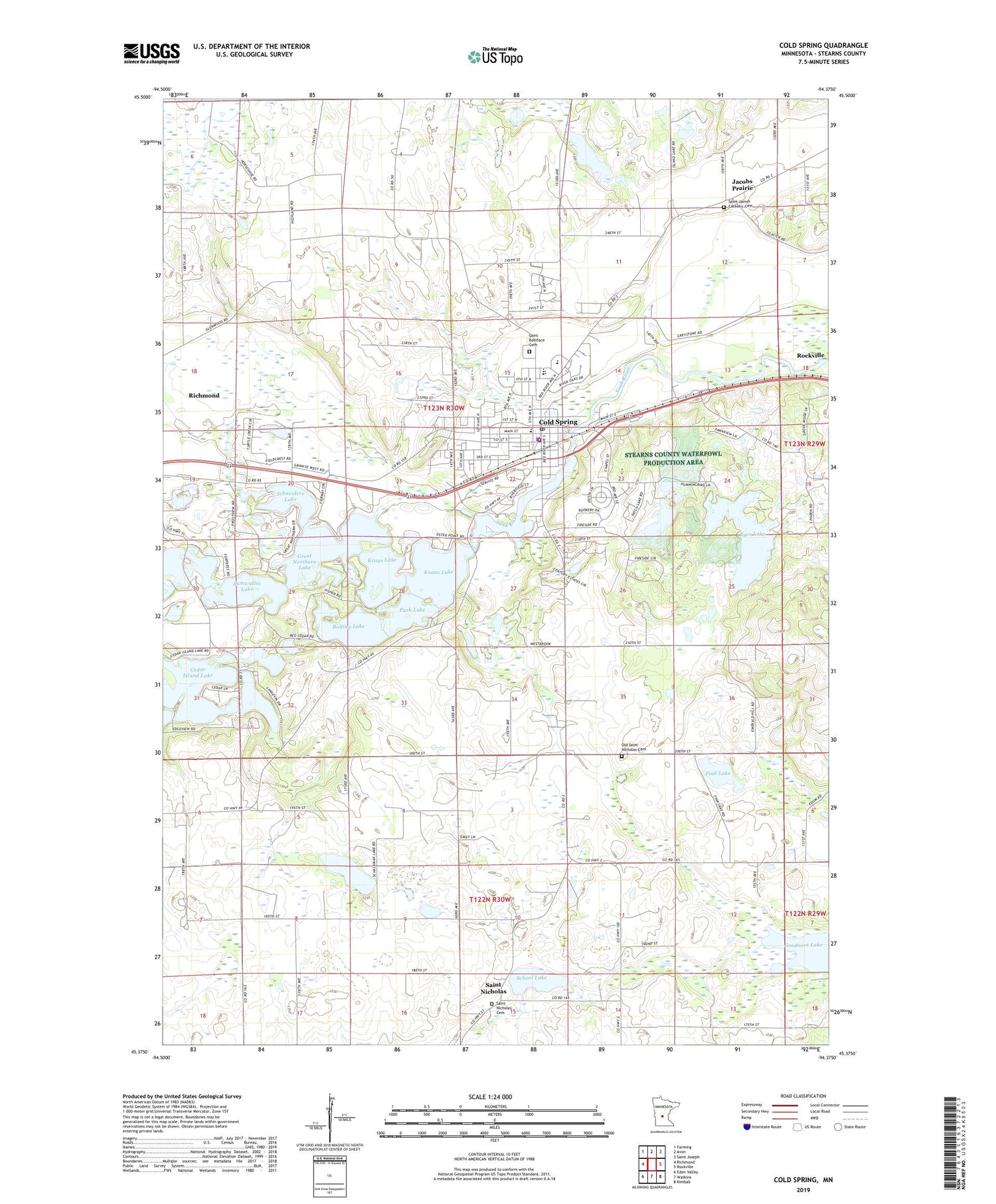
2019 topographic map quadrangle Cold Spring in the state of Minnesota. Scale: 1:24000. Based on the newly updated USGS 7.5' US Topo map series, this map is in the following counties: Stearns. The map contains contour data, water features, and other items you are used to seeing on USGS maps, but also has updated roads and other features. This is the next generation of topographic maps. Printed on high-quality waterproof paper with UV fade-resistant inks.
Quads adjacent to this one:
West: Richmond
Northwest: Farming
North: Avon
Northeast: Saint Joseph
East: Rockville
Southeast: Kimball
South: Watkins
Southwest: Eden Valley
Contains the following named places: Assumption Chapel, Assumption Home, Bolfing Lake, Byer Lake, City of Cold Spring, City View Golf, Cold Spring, Cold Spring - Richmond Police Department, Cold Spring Elementary School, Cold Spring Fire Department, Cold Spring Medical Clinic, Cold Spring Middle School, Cold Spring Police Department, Cold Spring Post Office, Cold Spring Rest Area, Cold Spring Roadside Parking Area, Dam Effects Series of Lakes, Fink Lake, Gertkin Marl Pits, Gloria Dei Lutheran Church, Goodners Lake, Great Northern Lake, Jacobs Prairie, KMXK-FM (Litchfield), Knaus Lake, Krays Lake, KZPK-FM (Paynesville), Old Saint Nicholas Cemetery, Old Saint Nicholas Chapel, Park Lake, Peace Lutheran Church, Rich Spring Golf Club, Rocori High School, Saint Boniface Cemetery, Saint Boniface Grade School, Saint Boniface Parish, Saint James Catholic Cemetery, Saint Nicholas, Saint Nicholas Cemetery, Saint Nicholas Post Office, Sauk River Dam, Schackman Lake, Schneiders Lake, School Lake, School Number 1926, Township of Wakefield, Zumwalles Lake, ZIP Code: 56320