MyTopo
Richmond Minnesota US Topo Map
Couldn't load pickup availability
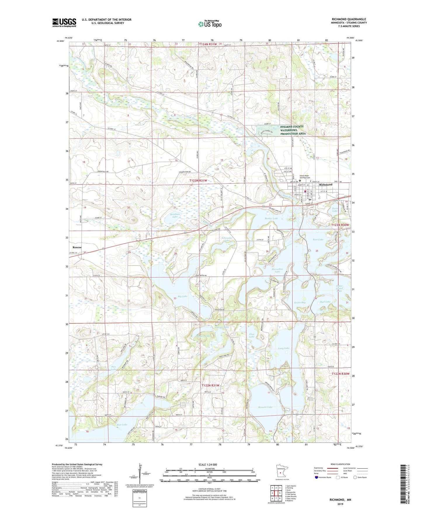
2022 topographic map quadrangle Richmond in the state of Minnesota. Scale: 1:24000. Based on the newly updated USGS 7.5' US Topo map series, this map is in the following counties: Stearns. The map contains contour data, water features, and other items you are used to seeing on USGS maps, but also has updated roads and other features. This is the next generation of topographic maps. Printed on high-quality waterproof paper with UV fade-resistant inks.
Quads adjacent to this one:
West: Paynesville
Northwest: Saint Martin
North: Farming
Northeast: Avon
East: Cold Spring
Southeast: Watkins
South: Eden Valley
Southwest: Lake Koronis
This map covers the same area as the classic USGS quad with code o45094d5.
Contains the following named places: Becker Lake, Big Lake, Browns Lake, Cedar Island Lake, City of Richmond, Cozy Corner Campground, Deep Lake, East Lake, Flint Lake, Ganzer Lake, Horseshoe Lake, KNSR-FM (Collegeville), Koetter Lake, Kolling Creek, Krons Bay, KSJR-FM (Collegeville), Long Lake, Meyers Lake, Morning Star Resort Campground, Mud Lake, Pirz Lake, Richmond, Richmond City Hall, Richmond Community Park, Richmond Elementary School, Richmond Fire Department, Richmond Medical Clinic, Richmond Police Department, Richmond Post Office, River Lakes Civic Arena, Roschien Lake, Saint Peter and Paul Catholic Church, Saint Peter and Paul School, Saints Peter and Paul Cemetery, Schroeder Lake, Thein Lake, Township of Munson, Your Haven Campground, ZIP Code: 56368