MyTopo
Eden Valley Minnesota US Topo Map
Couldn't load pickup availability
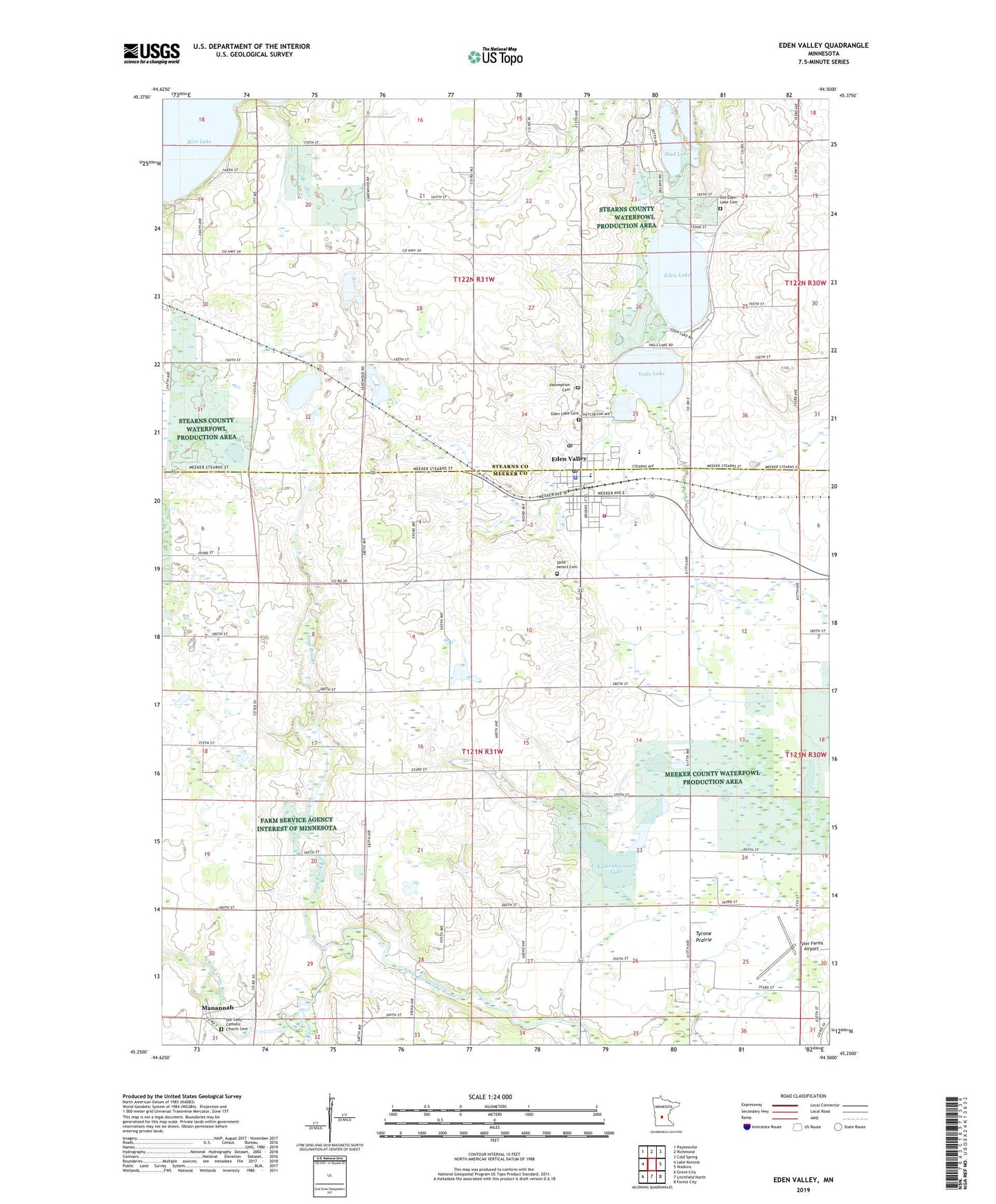
2022 topographic map quadrangle Eden Valley in the state of Minnesota. Scale: 1:24000. Based on the newly updated USGS 7.5' US Topo map series, this map is in the following counties: Meeker, Stearns. The map contains contour data, water features, and other items you are used to seeing on USGS maps, but also has updated roads and other features. This is the next generation of topographic maps. Printed on high-quality waterproof paper with UV fade-resistant inks.
Quads adjacent to this one:
West: Lake Koronis
Northwest: Paynesville
North: Richmond
Northeast: Cold Spring
East: Watkins
Southeast: Forest City
South: Litchfield North
Southwest: Grove City
This map covers the same area as the classic USGS quad with code o45094c5.
Contains the following named places: Assumption Cemetery, Assumption Parish, Becker Dairy, Church of God, Church of Our Lady of Manannah, City of Eden Valley, Eden Lake, Eden Lake Cemetery, Eden Valley, Eden Valley Baseball Park, Eden Valley City Hall, Eden Valley Elementary School, Eden Valley Fire and Rescue Department, Eden Valley Fire Department, Eden Valley Medical Clinic, Eden Valley Police Department, Eden Valley Post Office, Eden Valley Watkins High School, Fishers Resort and Campground, Grove Creek, Kalkenbrenner Lake, Mananah Post Office, Manannah, Meeker County Waterfowl Production Area, Middle Fork Crow River, Mud Lake, Old Eden Lake Cemetery, Our Lady Catholic Church Cemetery, Rice Lake, Rice Lake School, Saint Paul's Lutheran Church, Saint Peters Cemetery, Stag Brook, Township of Eden Lake, Township of Manannah, TTT Camp, Tyler Farms Airport, Tyrone Prairie, Tyrone School, Vails Lake, ZIP Code: 55329